Municipality of Kostoľany pod Tribečom
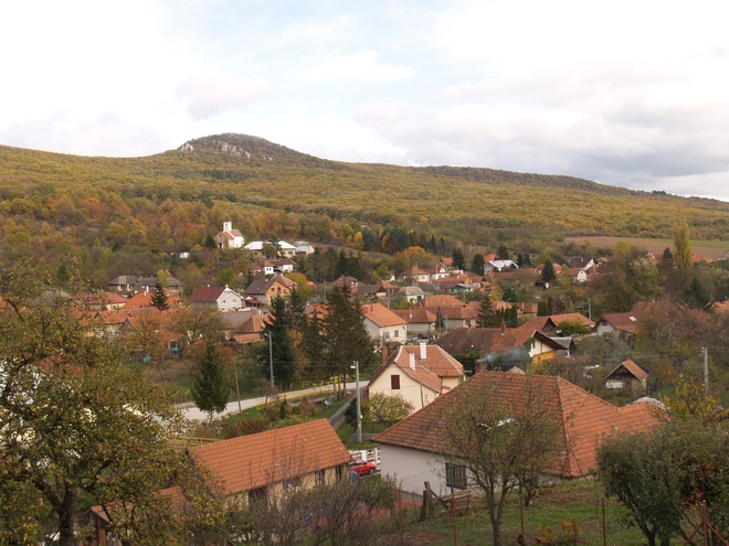
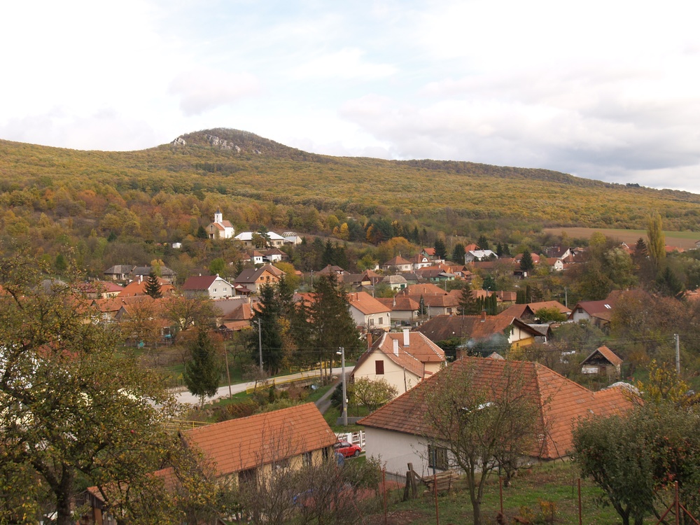
Kostoľany pod Tribečom is situated in the Kostoľany Basin, which forms part of the Tribeč Mountain. The promontories of the Žitava hill lands protrude into its southern part. The municipality covers an area of about 2,212 ha, the municipalities’ centre lies on a sea level of 242 m. 368 inhabitants had their residence here in 2012; the majority of which were of Slovak nationality and Roman-Catholic affiliation. However, almost a third of the houses belong to cottagers, who are staying only on the weekends.
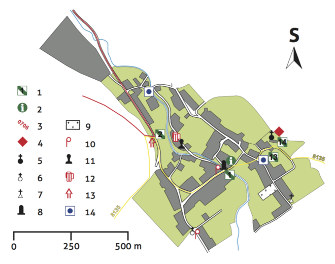
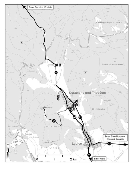
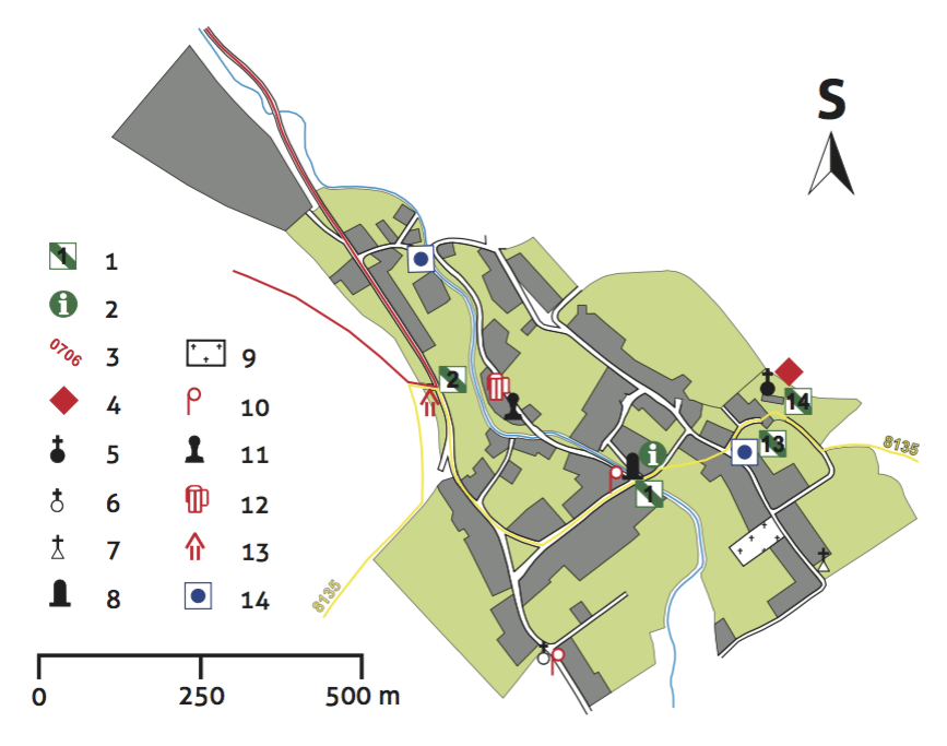
The starting point of the Kostoľany Educational Trail is situated in the centre of Kostoľany pod Tribečom, on a small square at the terminal stop of the suburban bus services; tourist signpost with the place name Kostoľany pod Tribečom, 225 MASL; yellow trail marking (8135); parking facilities.

Urban development
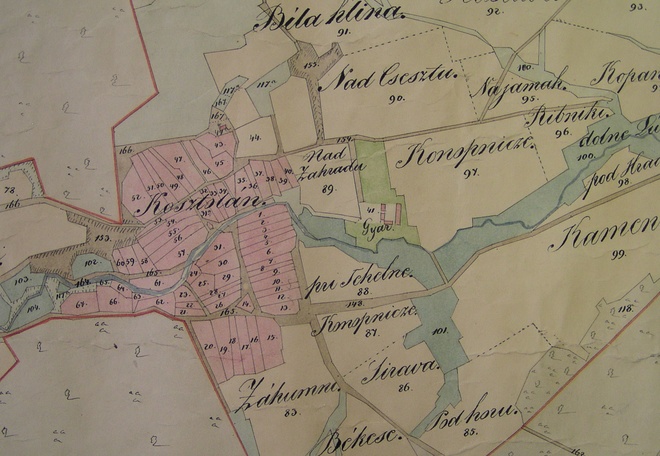
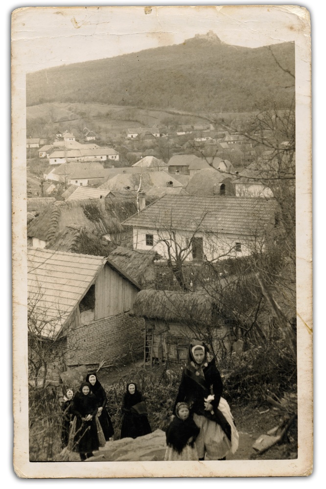
The character of the municipality was shaped by the structured terrain of the narrowest spot of the Kostoľany Basin and by Drevenica Brooch, which became an urban axis as well as an administrative border dividing Kostoľany into two parts. The structure of the buildings at nearby station No. 2, which developed along the Nitra and Tekov road branches from the Žitava Region to the centre of Nitra Region, highlights this division.
The broad ‘Hlavná ulica’ (Main Road) on the Nitra side of Kostoľany, transversely to the Drevenica Stream, appears as a new element. It has been estimated that it developed in the 13th century as a renovation of the older road leading to St George’s Street (station No. 14). In earlier times there was no square in Kostoľany, its role was played by the enlarged ‘Hlavná ulica’. The physical relief allowed for an increase in building density only in the direction towards the Drevenica Stream. Broader areas were added on the southern fringe of the municipality in the 18th and 19th centuries, when a new cemetery and a parquet factory were opened in the Tekov part of Kostolany.

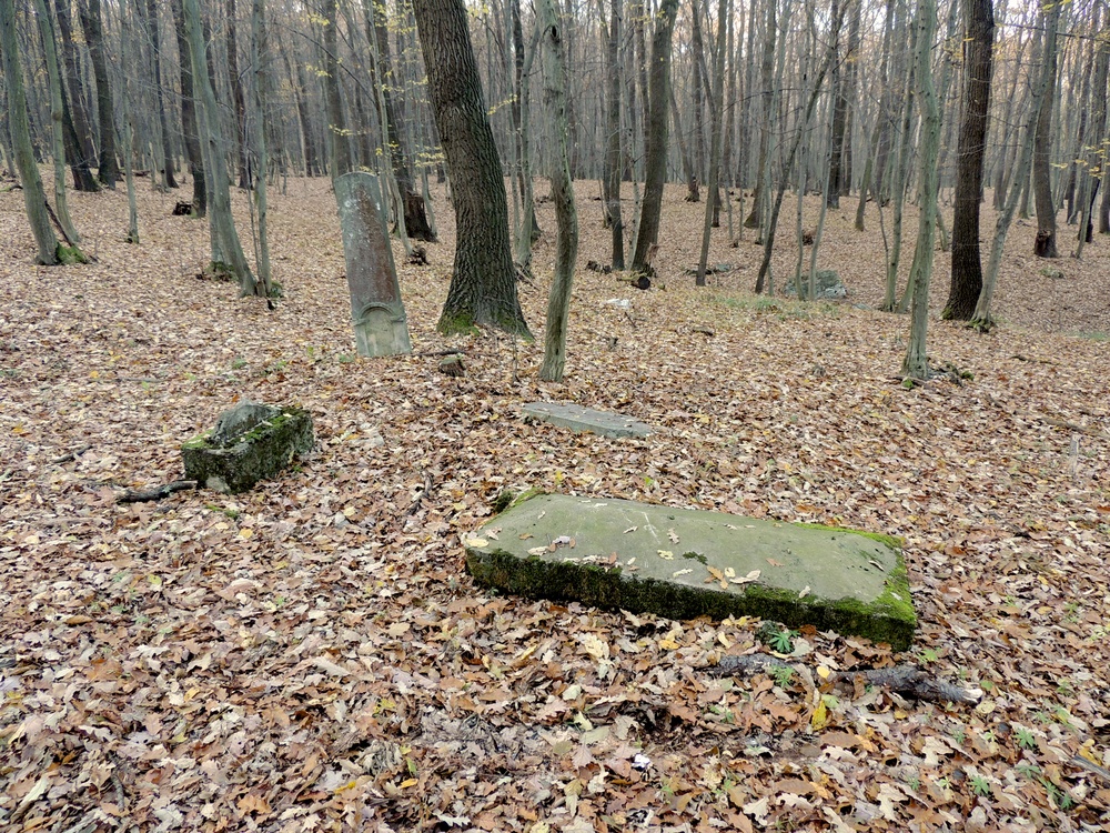
On the opposite side, in the Nitra part of Kostoľany, a Jewish cemetery was founded in the 19th century between stations No. 2 and 3. In the second half of the 20th century a collective farm developed on the periphery facing Jedliny.
Architecture
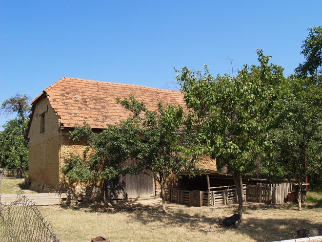
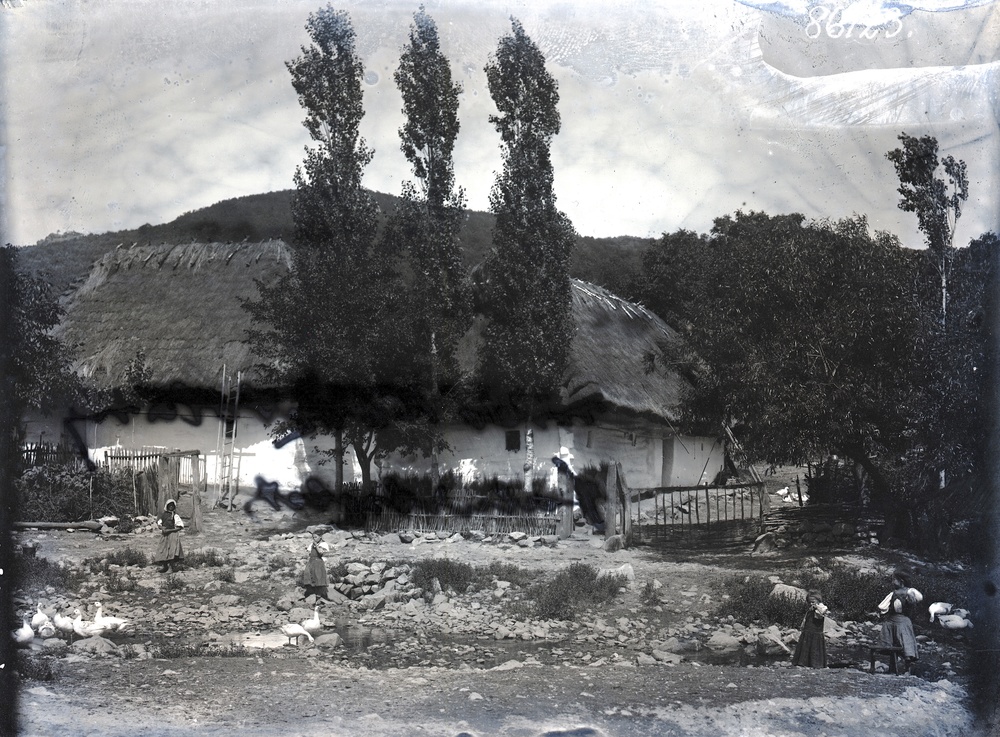
The first houses in Kostoľany were built of wood, had small windows and straw roofs.

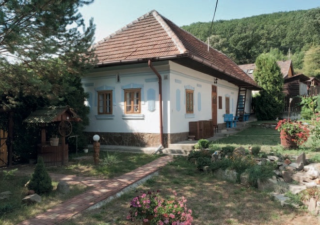
At the end of the 19th and beginning of the 20th century, as the product of various fires and the development of new building technologies, a number of houses were made of sun-dried clay bricks covered with ceramic tiles. Today they represent the oldest preserved dwellings in Kostoľany.

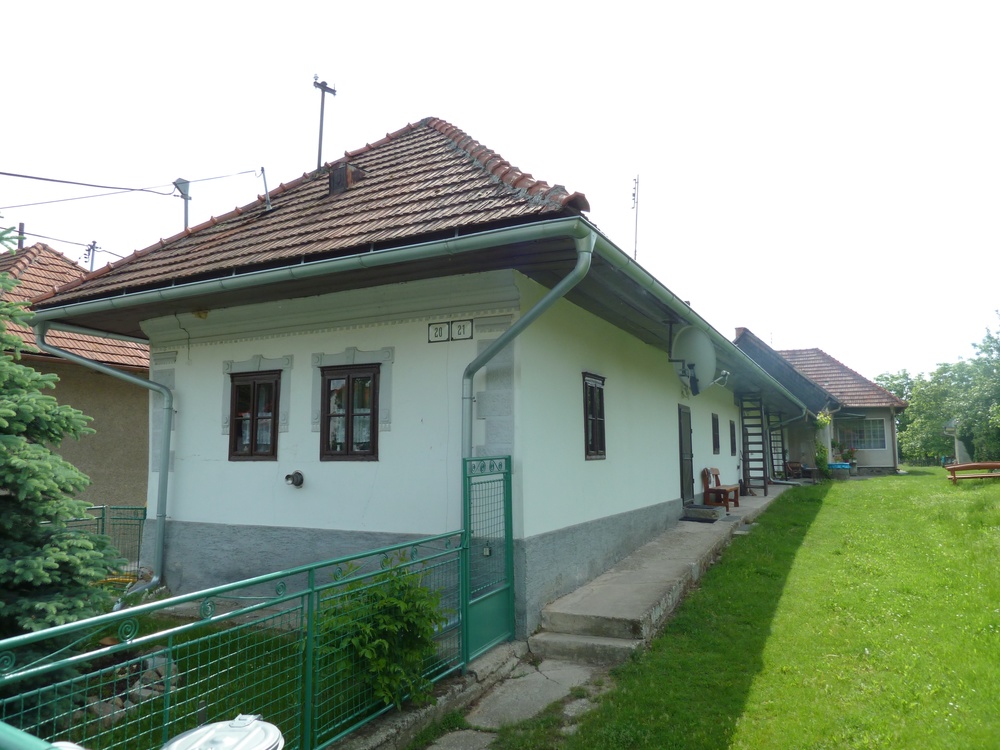
The houses were mostly oriented transverse to the roads, and showed the traditional tripartite or quadripartite layout with front lounge, hall, kitchen, and room. The façades were decorated symmetrically and had two axes. Only houses on the slopes are equipped with cellars that are entered from the front (house No. 138). Today we can see many nicely renovated houses of this type, with only slight modifications of the original proportions and colours of decorative details.

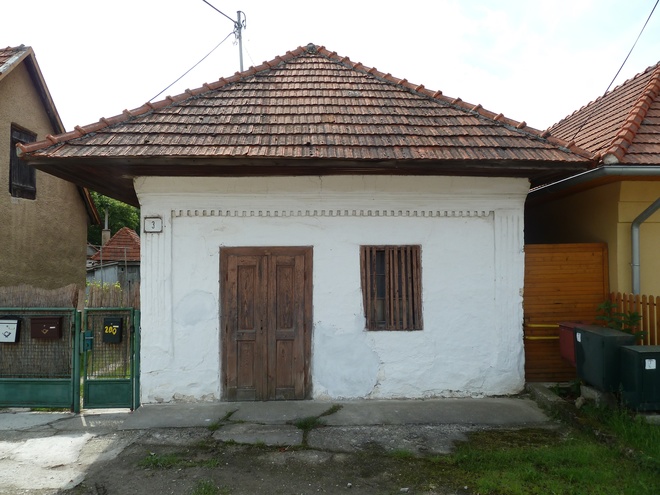
An unusual façade with an entrance from the road can be seen at house No. 3, in front of station No. 1 of the educational trail; originally there was a store here. To some extent barns of sun-dried bricks are preserved as well.
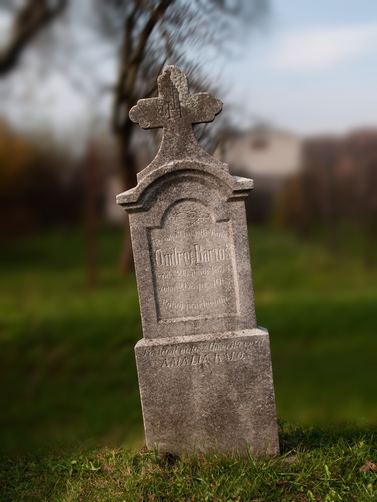
After World War II (1939–1945), the character of the architecture was changed by houses on a square ground plan with pyramidal or flat roof, typically with large windows and balcony, which developed mainly in the southern part, the community centre and the mourning house. Traditionally the buildings are added by historical small-scale architecture, wayside shrines, statues and crosses from the 18th–20th centuries (station No. 2). Special attention deserves the statue St Johann of Nepomuk on a pedestal on the southern border of the Tekov part of Kostolany, where the new cemetery is situated.

The history of Kostolany until the end of the 15th century
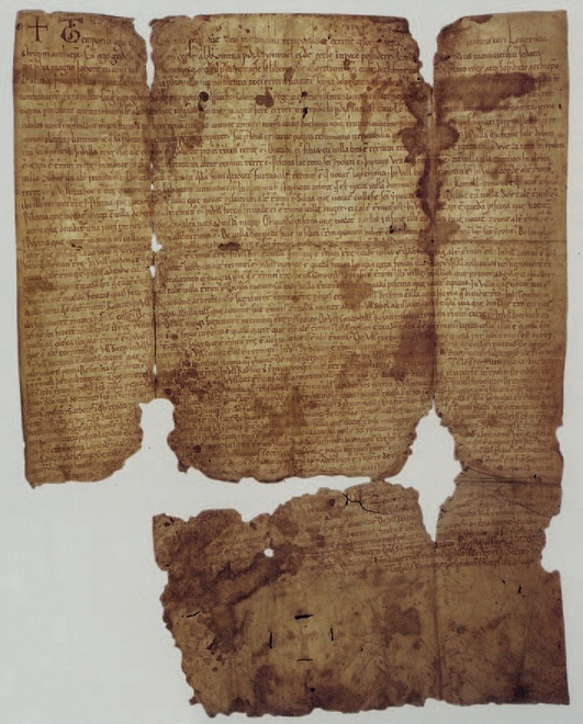
A settlement in the area of the municipality is proven at least from the Neolithic and Eneolithic periods (4800–2400/2000 BC). The most important Prehistoric archaeological site is the fortified settlement on Veľký Lysec Mountain (station no. 18). The first written record relating to the municipality stems from the first and second Zobor deed of AD 1111 and 1113, which contains a list of the properties of St Hippolytus’ Monastery at Zobor in Nitra.
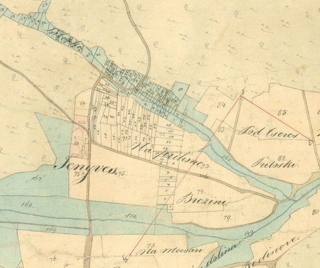
The territory of the municipalities was divided by a border leading in the middle of the Drevenica Stream already in the 11th century into two parts: the western half, belonging to the royal castle of Nitra, inhabited by ‘castle people’, and an eastern one with St George’s Church, the subject of St Hippolytus’ Monastery at Zobor. Until the union of both parts in 1873, Kostoľany developed therefore as two separate municipalities with own administrations.


Between 1241 and 1253 Kostoľany pod Tribečom was the property of Magister Ondrej of the Forgach Family, who had St George’s Church renovated. In 1304–1321 Kostoľany belonged to Matúš Čák, while the Forgáčs regained control over it only in 1386; with the exception of the first half of the 16th century, they owned the municipality until 1945. The history of Kostoľany was marked by probate disputes between Peter and Mikuláš of Forgach and by disputes between those two and the Archbishopric of Esztergom in the 15th century.
Kostoľany in the 16th–17th centuries
During the Ottoman (Turkish) occupation in the 16th century both parts of Kostoľany belonged to the Sanjak of Esztergom. By then Kostoľany is estimated to have consisted of about 150–200 inhabitants in 24 houses. Most of the municipality was looted in 1570. In 1647 a school was mentioned in Kostoľany for the first time. Kostoľany suffered for the whole 17th century from anti-Habsburg rebellions of the Hungarian nobility, especially during the rebellion of Franciscus II Rakoczi in 1704 and 1705, when Kuruc forces appeared in the municipality.
Ethnic structure
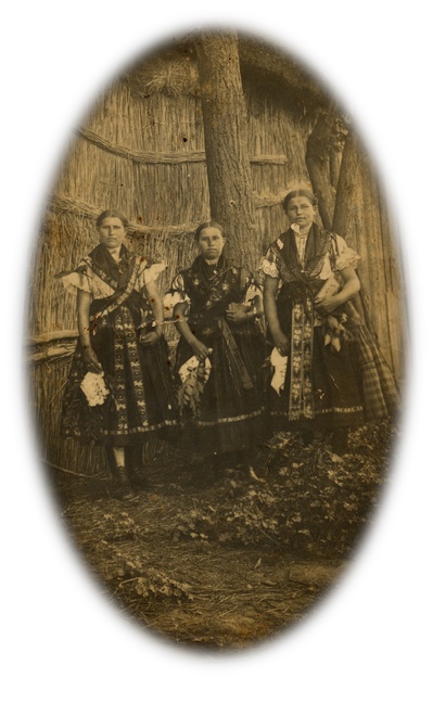
In the 16th century Kostoľany was a Slovak village. According to the first mention on its inhabitants from 1549 and according to other sources, this was the result of close family bonds with the Slovak community in central Nitra, which was historically based on the development in the preceding centuries. The Hungarian-Slovak ethnic border followed the line Žirany – Jelenec – Ladice – Beladice – Nový Tekov. In the 16th century, after the looting by the Turks this territory was definitely hungarised by settlers from the southern ethnic Hungarian municipalities (station No. 28). Until the 1940s there were also some Jewish families that had come here about 1850.
The economic situation in Kostoľany until the end of the 19th century
Due to its foothill climate, Kostoľany was one of the smallest and poorest municipalities in the territory of Tribeč. It was composed only of poor farmers and lodgers, and there was no manor farm. From the economic point of view, there was unsufficient ploughing land in Kostoľany, forestry and animal husbandry prevailed. Vine was cultivated as a supplement in the 16th–18th centuries. From 1647 stems the first written mention of the farmstead Jedliny, which belonged to the Forgáčs and was a subdivision of the manor of Gýmeš. Until 1945 Jedliny, which specialised in animal husbandry and forestry, was the largest agricultural firm in the municipality. Two water mills stood in the municipality. The oldest mention of a mill stems from 1613. The mill south of the village at the border to Ladice operated still in the 20th century and grinded discarded metal. In 1818 the parquet manufactory built by the Forgáčs southeast of the centre was mentioned. It was the first machine manufactory for parquets in the Hungarian part of the empire and a unique technical facility in its time. The factory was in operation still in 1870 and was demolished in the first quarter of the 20th century.
From 1647 stems the first written mention of the farmstead Jedliny, which belonged to the Forgáčs and was a subdivision of the manor of Gýmeš. Until 1945 Jedliny, which specialised in animal husbandry and forestry, was the largest agricultural firm in the municipality. Two water mills stood in the municipality. The oldest mention of a mill stems from 1613. The mill south of the village at the border to Ladice operated still in the 20th century and grinded discarded metal.
In 1818 the parquet manufactory built by the Forgáčs southeast of the centre was mentioned. It was the first machine manufactory for parquets in the Hungarian part of the empire and a unique technical facility in its time. The factory was in operation still in 1870 and was demolished before 1892.
Kostoľany in the 20th century
In 1909 and 1915 Zoltán Kodály, a famous Hungarian composer collected Slovak folk songs. It was his merit that in 1911 the first worthy collection of photographs of architecture folk costumes was called into being. In 1944, during World War II (1939–1945) a bomber crashed in the nearby forests. The pilots of the aircraft were saved by the help of partisans. The Kostoľany citizen Ján Segíň, who helped them, was shot by the Germans near station 1; today he is buried in the new cemetery. In 1948 Kostoľany was electrified and since 1953 there is a bus line connecting Kostoľany pod Tribečom and Nitra. In the second half of the 20th century Kostoľany had the densest population culminating in 1975 with 723 inhabitants.
History of the placename Kostolany
Costelan mentioned in AD 1111 Kestek, 1113, Koztulan (1253), Gymessowské Kostelany (1808), Dýmeš Kostolany (1920), Gýmešské Kostolany (1927) and since 1948 Kostoľany pod Tribečom
Interesting events
A Mariáš Contest (January 6), an Easter Contest in table tennis and a mayors’ touring cup (every Easter Sunday), a contest in goulash cooking – Guláš HAM connected with sports games for children (August–September), St Gorazd’s celebration (last Saturday of July). On the northern fringe of the Kostolany Basin, on the border of the Landscape Preserve Ponitrie lies the recreation facility Jedliny with a natural bath and tourist accommodation.