Municipality of Ladice
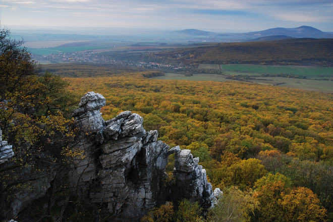
The largest part of the 1,165 ha of the municipality is situated on the northern border of the Žitava hill land. The northern part of the cadastre reaches the Tribeč Mountains: the southern slopes of Malý Lysec (492 MASL) and the south-eastern foothills of Dúň Mountain (513.8 MASL). The municipality centre lies on an altitude of 197 MASL in the valley of the Drevenica Stream. In 2013 there were 777 inhabitants in the municipality.
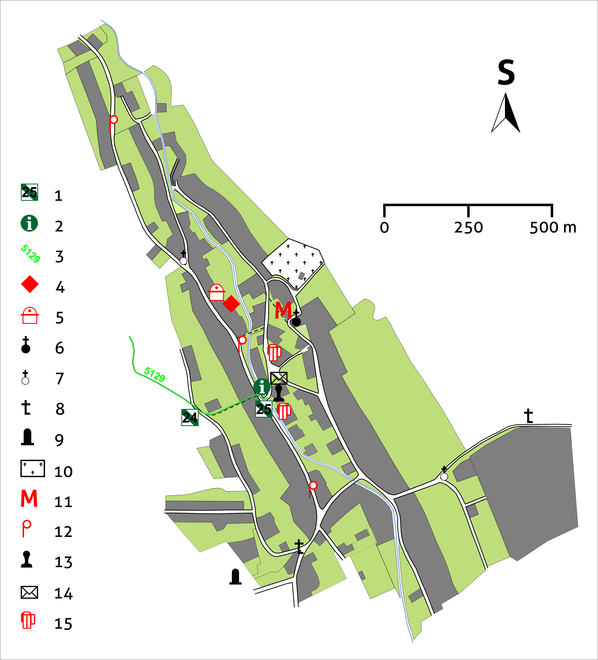
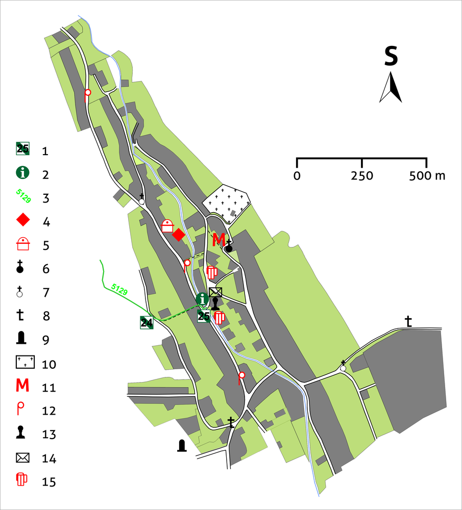
The green marking (5129) turns at No. 24 to a narrow trail amidst the gardens on the main road from Ladice to Kostoľany pod Tribečom. It crosses a bridge on the Drevenica Stream and leads to the touristic signpost Ladice, OcÚ, 196 MASL; parking opportunities. Time: 3 min., in the opposite direction 3 min., length: 0.2 km, easy.
Ladice since the end of the 19th century
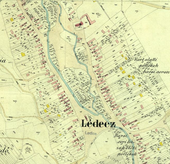
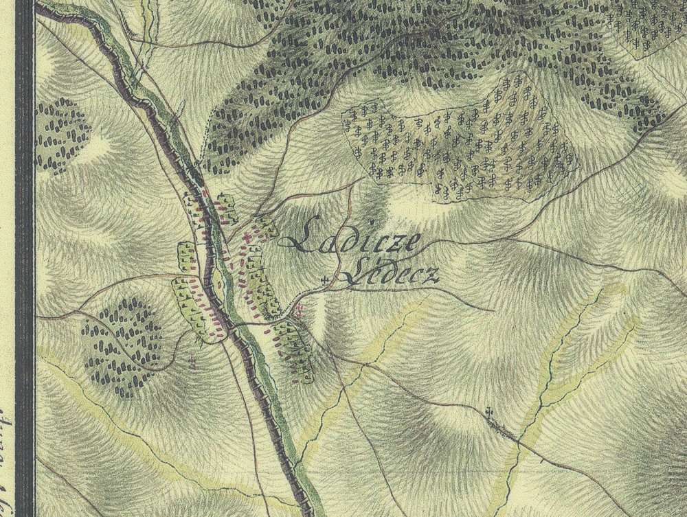
Ladice is marked by the route of historical roads at the entrance to the Kostoľany basin and the administrative split between the two counties of Nitra and Tekov. Both parts are divided by the Drevenica Stream and a differing physical relief. Today the historical centre consists of two streets: the Nyitrai sor (Nitra line) and the Barsi sor (the Tekov line), which developed along the banks of the Drevenica Stream already in the 13th century. In the 15th century the buildings of the parish with the All Saints’ Church were built above both streets.
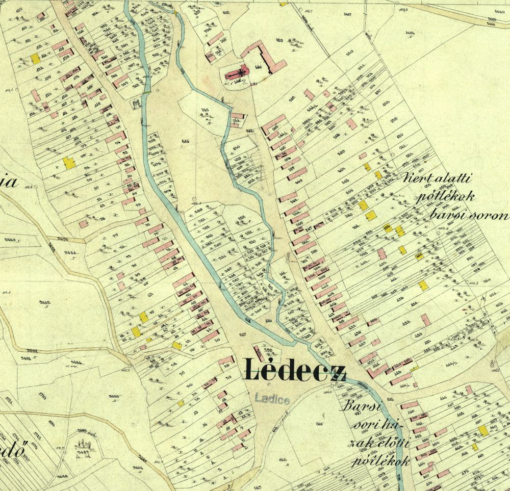
In the mid-16th century at the latest, a large mill island developed by dividing the area with a canal pound for the upper (Horný) and lower (Dolný) mill between the Nitra and Tekov lines. This island was used only for gardening until the end of the 19th century.

Changes in the 20th Century
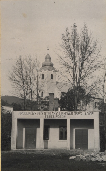
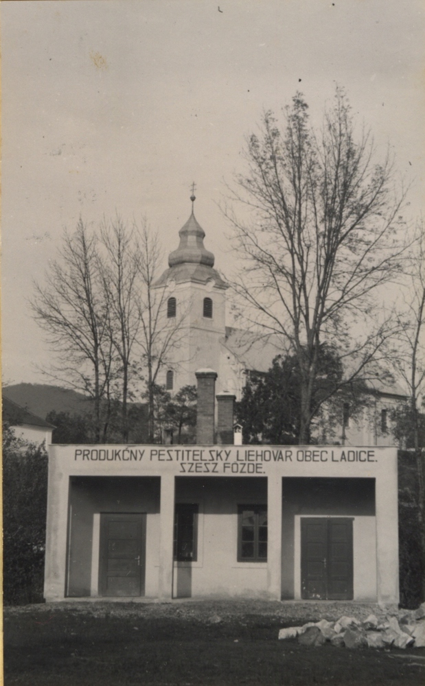
In the first half of the 20th century the southern part of the mill island (called na Beregu) and the southern connecting road between the Nitra and Tekov lines was covered with buildings. A number of them stem from the time after the end of the 1930s. Still extant is the renovated building of the municipal distillery (1939), the building of the old Miestný národný výbor (MNV) and the old fire station (1950), the culture centre and the Jednota restaurant (1960s), and finally the new MNV building with a Jednota grocery, the post office, which is today’s municipal office (1981). In the northern suburb at the road to Kostoľany pod Tribečom a quarter called Nové Ladice (New Ladice) developed in the second half of the 20th century; most buildings there stem from the 1950s and 1960s. In the southern part of Ladice, at the entrance to the municipality a new school building was erected. Since the end of the 1950s the agricultural cooperative spreads at the road to Sľažany and Velčice.
Architecture
Parish Complex
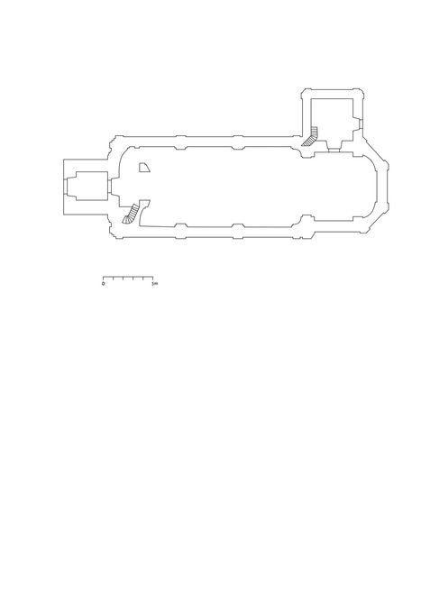
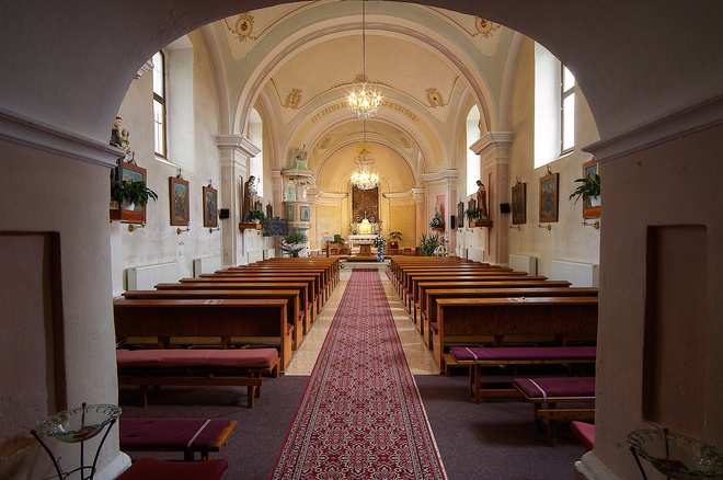
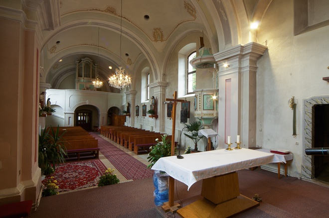
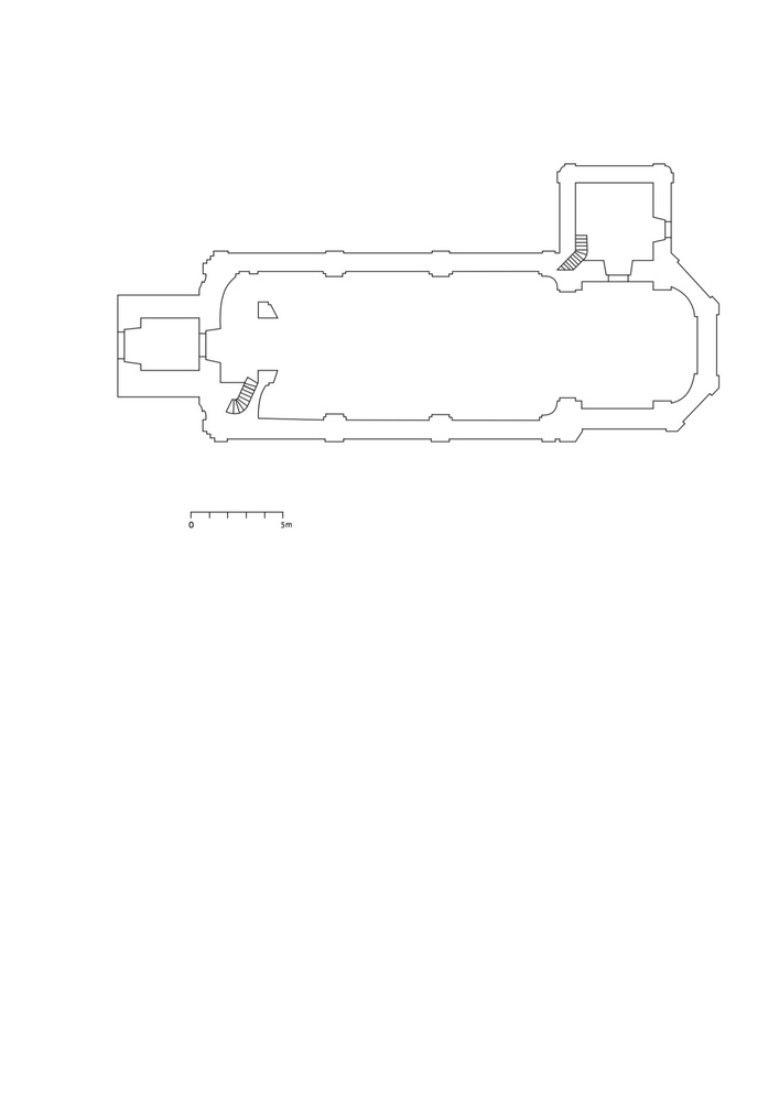
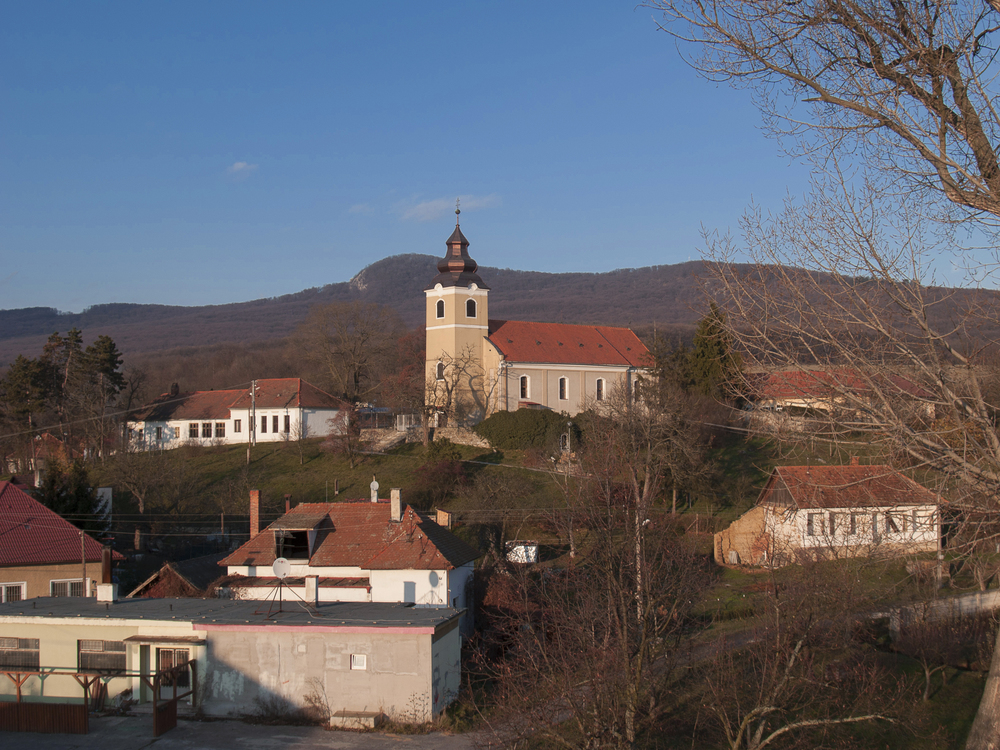
The architecture of the municipality is dominated by the Roman Catholic All Saints’ Church. It developed in the 18th century after the rebuilding of the gothic church from the 14th and 15th centuries. Today fragments of the exterior Renaissance plasters on the tower and in the attic are the only remnants of earlier construction phases. The rectangular aisle and the presbytery with polygonal apse show Prussian vaults. The walls are interspersed with pilasters displaying deeply carved capitals.
The main altar contains an interesting figural painting of All Saints from 1792. Also the pulpit from the end of the 18th century and the pipe organ from 1804 are artistic masterpieces. In the 1970s a Lourdes Cave was inserted into the church wall, containing the statue of the Virgin Mary. The church was surrounded by a cemetery until 1779. A parish was built behind the church in 1749. It consisted of four rooms for housing, a large hall served as accommodation for the priest’s relatives, a cellar, chamber, stall, a large silo, and a garden with fruit trees.
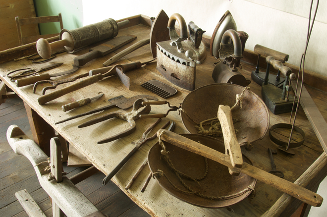
Next to the church you will see the old Catholic church school from 1774, which was subsequently renovated and enlarged for a number of times. The building contained classes and a staff room for the teachers and the director’s apartment. Today the school houses exhibits an ethnographic collection from Ladice.
Folk Architecture
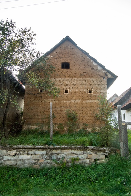
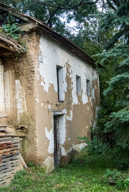
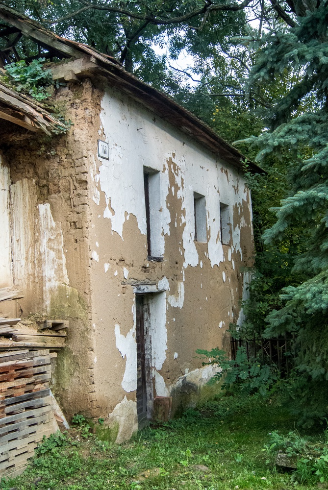
The oldest extant houses in the Nitra as well as Tekov part stem from the end of the 19th and the beginning of the 20th centuries and are built of sun-dried bricks. House no. 100 in the Nitra part, a protected national cultural monument, is the only one having preserved the traditional porch.

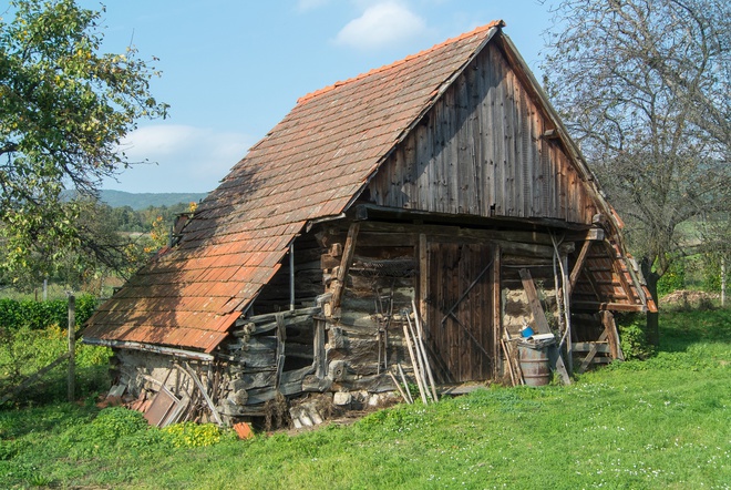
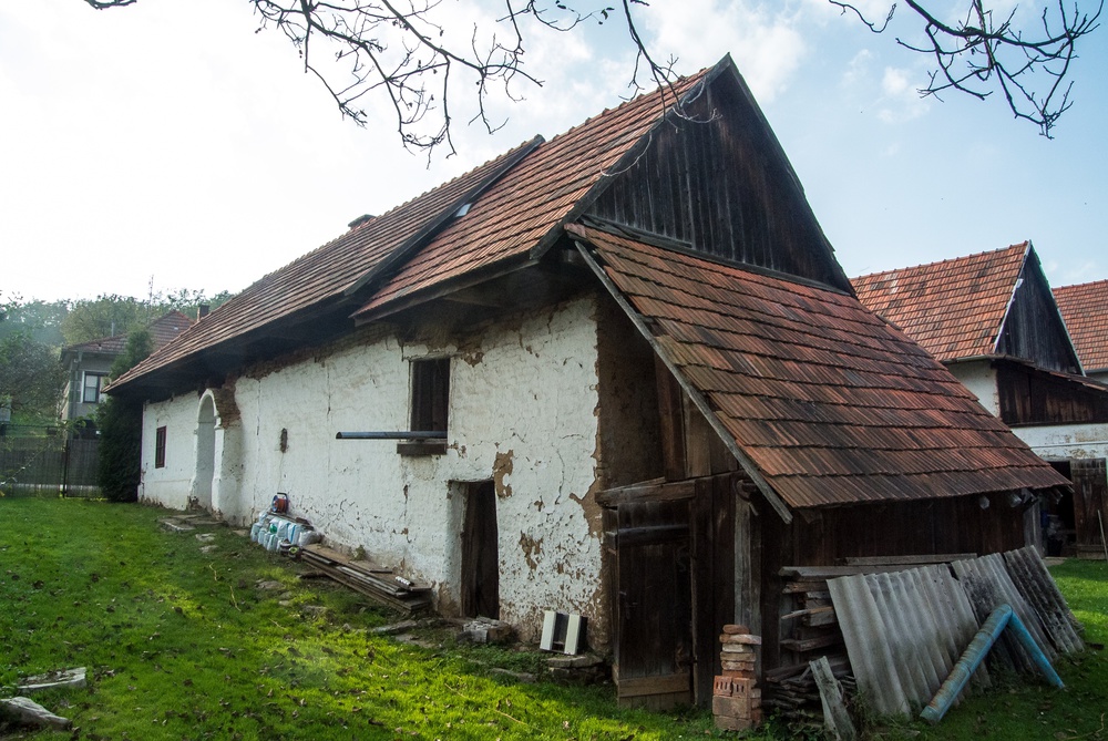
The ground plan consists of only one wing, divided into three parts, the four rooms are: entrance hall, hallway, smoke kitchen, and a chamber. The economic area (maštaľ) is situated in the rear part of the house. The inter-war period saw the construction of hallway- or veranda-houses. Two-part houses with kitchen and hall but without economic area were erected. Cellar with entrance on the face occur only exceptionally in the Nitra part. The oldest houses display smooth plasters painted with white lime. A geometrical division of the façade and geometrical decoration occur only after the 1930s. Sometimes even the plastic decoration around the windows as well as niches with statues of the saints on the street façade. Typical houses on a square ground plan with pyramidal roof and a scratched mineral plaster (brizolit) decorated with sgraffito or mosaics have gradually replaced traditional folk architecture. Among the agricultural buildings of the second half of the 19th and the first half of the 20th century mainly barns and stables of wood or sun-dried bricks have been preserved, the original straw roofs have all been replaced by roofing tiles.
Mills
Today only the building of the ‘Horný’ (Upper) Mill with a dwelling in the northern part of the Tekov line is partially preserved from what originally were three mills since the 16th century. The building of sun-dried bricks is in a very bad state. East and north of the mill we can see the canal pound. The mill operated until the 1950s, when the technical equipment was removed. The concrete construction of a mill from the 1940s in the southern suburb, which has replaced the historical Chotárný Mill, has been renovated for residential purposes.
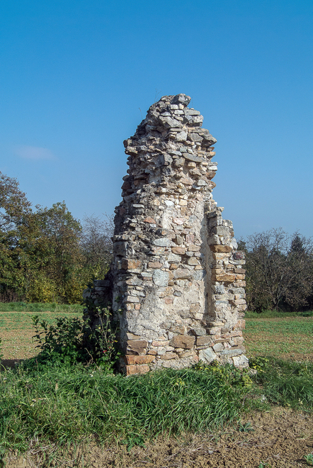
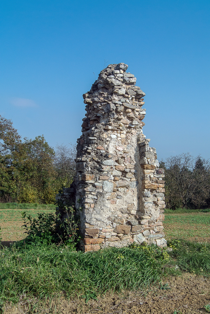
Turkish Monument
The ruins of a historical monument are preserved in the midst of a field on the southern border of the municipality, at the asphalted road to Jelenec. Originally it was an obelisk with a rectangular pillar decorated with rectangular niches and a high cone on its top. Only the rectangular pillar with the remains of plaster and the lowest part of the cone are preserved today. The monument seems to have been erected sometime between 1650 and 1750.
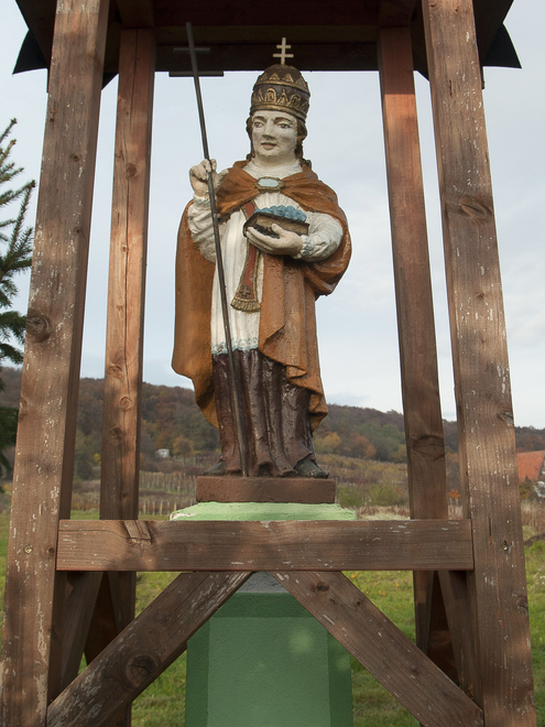
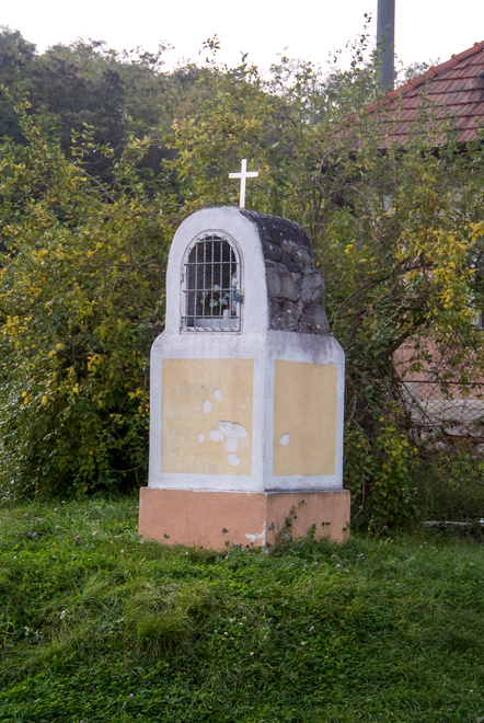
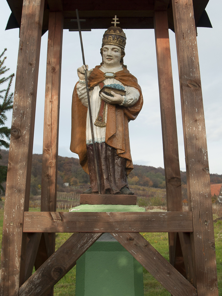
Small-scale architecture
Among the examples of small architecture we may mention the statue of St Urban from 1834, which is standing in the Tekov part of the municipality. A wayside chapel from the mid-19th century stands on the crossroad of a hollow way in front of the area of the former agricultural cooperative.
Interesting events
Meeting of football fans under the auspices of Eugen Szabo (July), harvest and folklore festival (September), the mayor´s Christmas table tennis cup (December/January).