Municipality of Velčice
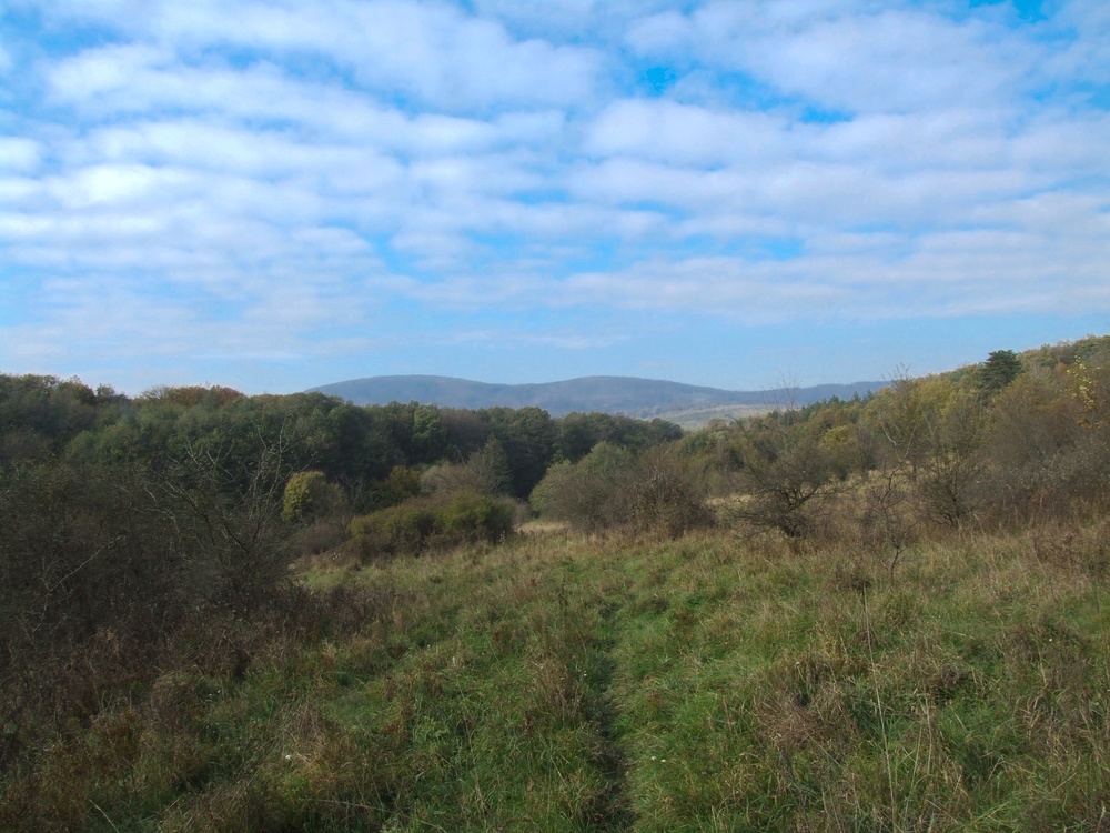
The territory of Velčice is situated in the valley of the Čerešňový potok stream, on the border between the mountain ranges of Tribeč and the hills of Žitavská pahorkatina. It covers an area of 3,470 ha. The municipality’s centre is situated in 223 MASL; the highest spot of municipality is the Veľký Tribeč Mountain (829.6 MASL). In 2013 Velčice had 832 inhabitants.
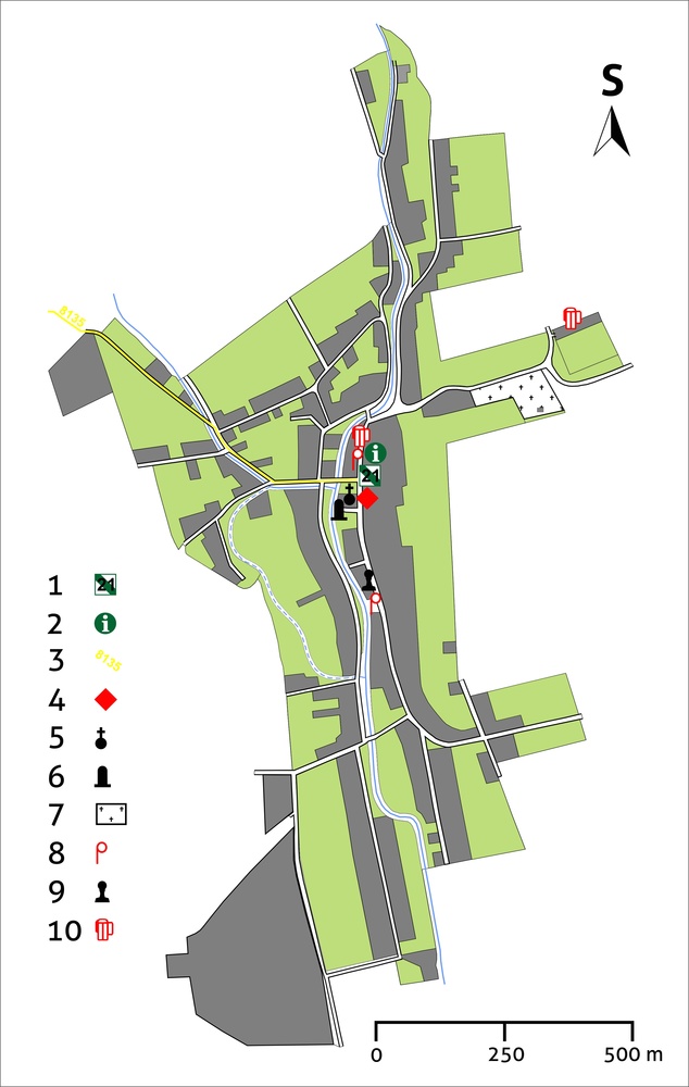
The yellow marking (8135) descends from station No. 20 on a field road to the southeast through an overgrown meadow. After about 300 m we enter an asphalt road and turn to the right, to Velčice. In the opposite direction we have to remember to turn to the asphalt road left, from the northwest. The markings are set on iron posts. The yellow marking continues on the local road to the tourist signpost on the square, designated as Velčice on an altitude of 225 MASL.; parking opportunities. Time: 25 min., in the opposite direction 35 min., length: 1 km, easy, in the opposite direction medium challenging.


The territory of Velčice is situated in the valley of the Čerešňový potok stream, on the border between the mountain ranges of Tribeč and the hills of Žitavská pahorkatina. It covers an area of 3,470 ha. The municipality’s centre is situated in 223 MASL; the highest spot of municipality is the Veľký Tribeč Mountain (829.6 MASL). In 2013 Velčice had 832 inhabitants.
Velčice until the end of the 19th century
On the territory of Velčice there are a number of finds of the Eneolithic Lengyel and Baden Cultures (4800–2400/2000 BC) and a cemetery of the Lusatian Culture (800–600 BC). Parts of the Lusatian fortified settlements of Veľký Lysec (station No. 18) and Veľký Tribeč are situated within the cadastre of Velčice. The first written attestation of Velčice stems from 1232. At that time, courtiers from Nitra Castle spent their time in the village called Welchez. In 1386 Blasius Forgach acquired the village, and thereafter it was held by his family, with minor interruptions, until the abolition of serfdom in 1848.
A number of buildings were erected in the 13th century: a castle with fortified area on the north-eastern slope of Svinec, the castle Čierny hrad on the cadastral border to Zlatny, and approximately in the centre of today’s municipality the processor of the parish church of St Michael.
Velčice was one of the largest municipalities in the Tekov County. The house census of 1598 lists 58 taxed houses and the untaxed houses of the Schultheiß (akin to today’s mayor), the priest, and the herder. The neighbouring Turkic Esztergom marked the life of the Tekov County until the Turkic defeat at Vienna in 1683. The life of the municipality was unfavourably marked by the anti-Habsburg uprisings of the Hungarian nobility and religious riots in 1604–1711. Before 1698 the municipality was governed by the family of the Fánchyov, and since the beginning of the 18th century it formed part of the dominion of the Migazzi from Zlaté Moravce. In 1740–1743 the group of Church buildings was added by the Holy Cross Chapel and the Chapel of Our Lady of Sorrow (in more detail see station 20). A Church school has been known only from written records in 1841; however, teachers were mentioned already in 1742.
The economic situation in the 16th to 19th centuries
The inhabitants of Velčice made their living on crop and viticulture (attested already in 1564). There was far too little arable land; however beautiful meadows and pastures enabled animal husbandry. Coopery was widespread since the 18th century. In the 1830 a glassworks was founded by the Forgach on the meadow below Kľačany on the Čerešňový stream. It was closed at the end of the 19th century. During World War I a water-powered sawmill was erected at its place, which burned down after the war.
Velčice in the 20th century
After 1918 local farmers were extensively buying arable land and forests from the Forgács and from surroundings great landowners. In 1929 they founded a loan cooperative in the municipality and also a Food Cooperative (Potravné družstvo) was founded in 1936 to support the local economy.
Until World War II some Jewish families and Wallachian Romas settled here. Until 1940 they temporarily lived in Uhlisko, where brick earth was dug. During the Slovak State (1939–1945) a number of roads were reconstructed, in 1940 the municipality was connected to the telephone network and three years later the reconstruction of the primary school started, which was finished in 1947.
In 1951 bus transportation between Velčice and Zlaté Moravce started; the Chapel below Svinec Hill was renovated from 1951 to 1953. Six years later an agricultural cooperative founded, which ended the system of crop rotation by the local farmers. In the 1960s and 1970s the local citizens built a cultural centre and a mourning house. A distillery and a dam above the municipality belong to the local technical buildings. In 1986–1987 the consolidated agricultural cooperative in Velčice (called ‘Svornosť Neverice’) built a farm with a fallow deer farm on an area of 174 ha.
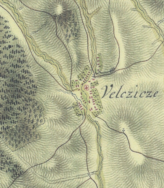
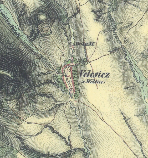
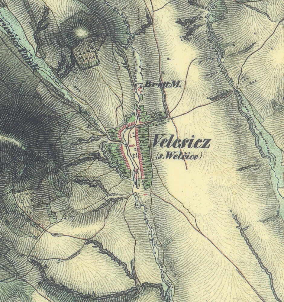
The municipality is referred to under different names in the written records: Welchez (1232), Welchuch (1270), Welchez (1536), Welezicz (1598), Welczicze or Velcsicz (1773), Welčice (1808), Velsic (1888–1902), Velséc (1907–1913), and Velčice since 1920.
Urban development
The urban plan of the municipality was shaped in the 13th century. Around the late Romanesque parish church, on both sides of the Čerešňový stream, two main roads developed in the parts called Veľká and Malá strana (Larger and Lesser Town), which houses that are oriented mostly transversely to the road. The first known parish stood opposite to the church, at Malá strana. After a fire in 1713 it was situated on the opposite bank of the stream, on the way to Mankovce. The current building stems from 1955. The stream banks were not built up until Modern times. One of the first buildings on this territory was a blacksmith’s shop on the place of today’s apartment houses. The ground plan of Velčice remained stable until the end of the 19th century. The other roads, or the projections of the old streets, developed only in the 20th century, especially after 1945 (for example the sites Pod Hôrkou, Uhlisko, the upper part of the K priehrade Street). In the second half of the 20th century the ground plan was added by a number of buildings. After the new school building was finished in 1947 a repository of the fire brigade was erected, a nursery (1960s–1970s), and the modern building of the municipal office (1974). The upper part of the central zone of the municipality was added by commercial infrastructure (restaurant, grocerzy and a butcher’s shop).
Architecture

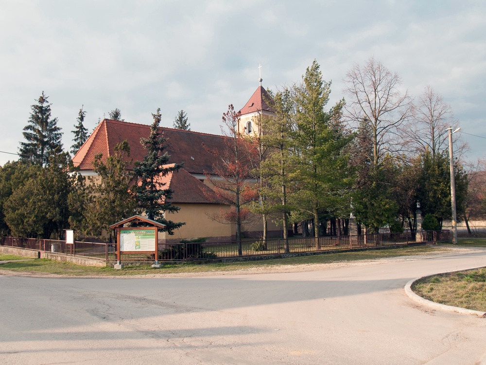
Church of the Holy Trinity
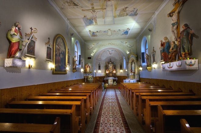
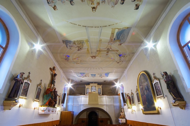
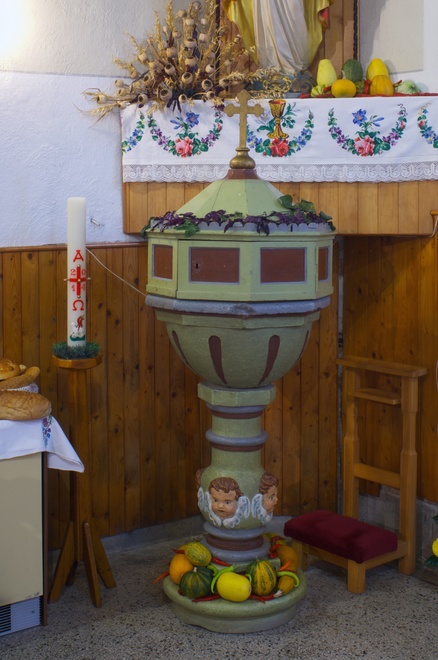
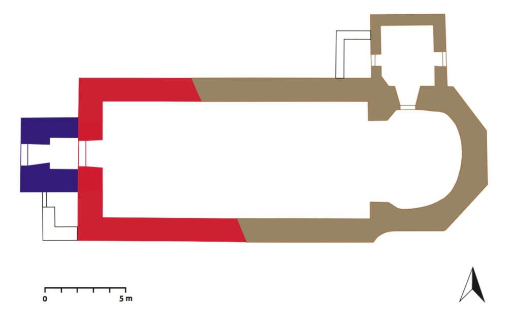
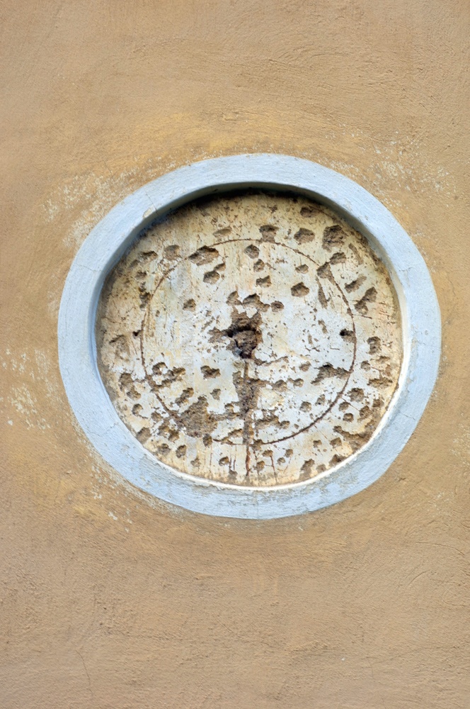
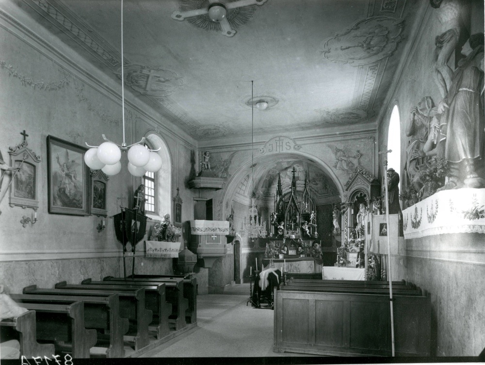
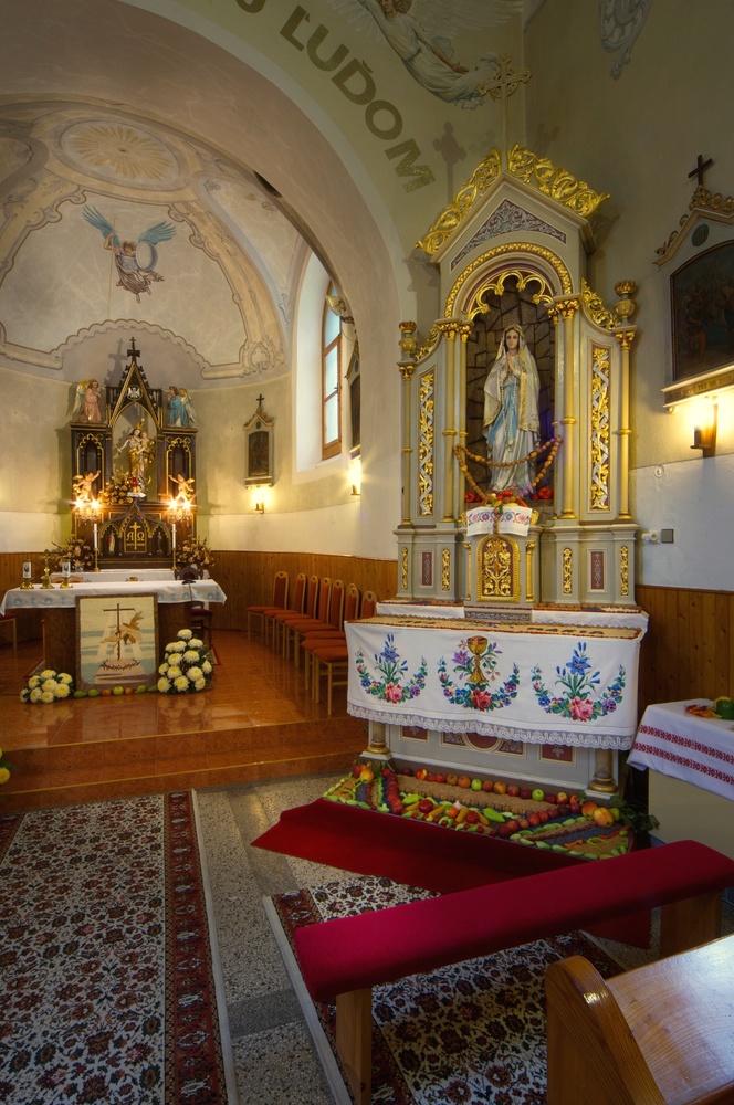
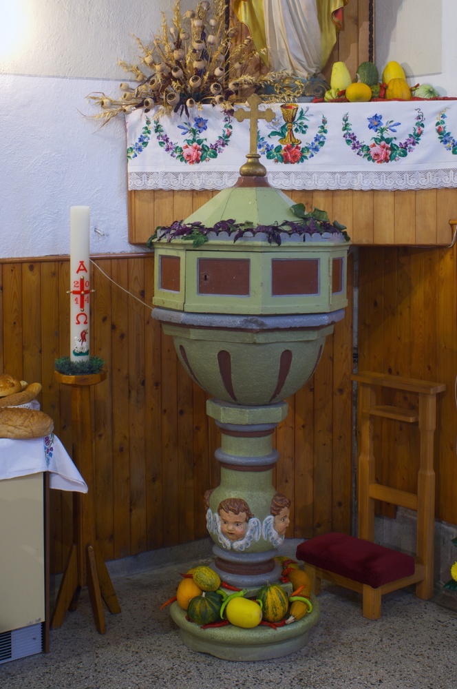
The single-aisled Baroque building with polygonal presbytery, an attached sacristy and tower from 1719 developed after the reconstruction of the Renaissance Archangel Michael Church, which had been destroyed by a fire in 1713. The walls of the nave and the tower were incorporated into the new Baroque building. Late Romanesque windows from the second half of the 13th century, paintings showing St Christopher, St Dorothy on the western façade, which was damaged by the construction of the later Renaissance tower, were found during the building-historical research. These paintings from the 15th century were covered with Baroque plasters. The interior of the church shows an even ceiling, except for the conch. In 1985 to 1990 it was decorated by a painting by Peter Čambál. The even ceiling from 1934 replaced the damaged Baroque vaults of the nave. Painted Baroque and Rococo statues of the saints and the Virgin Mary, a Calvary group on the eastern wall of the church and a Baroque baptismal font of stone are among the oldest equipment of the church, the rest stems from the 19th and 20th centuries.


Small-scale architecture
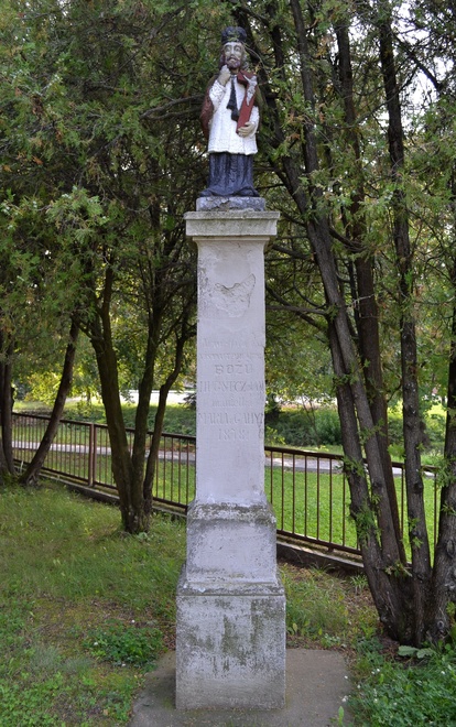
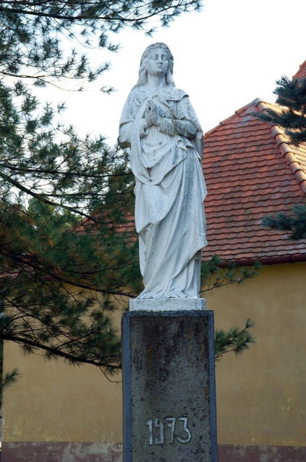
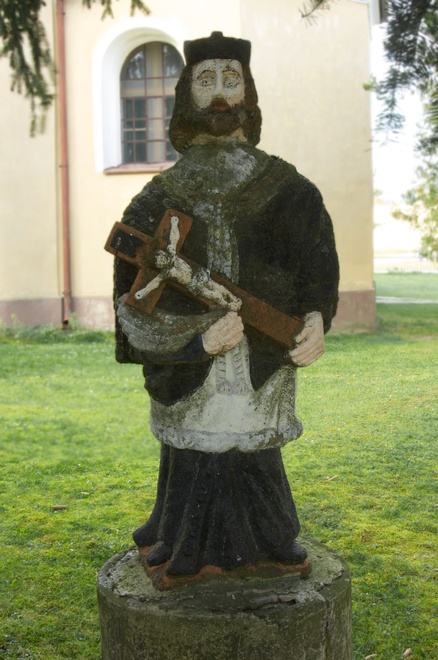
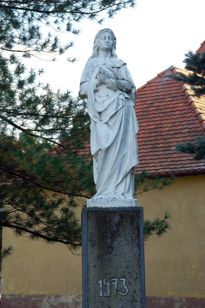
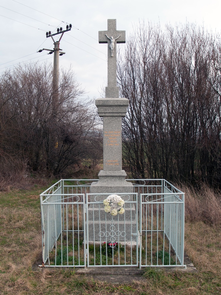
At the Holy Trinity Church there are three statues: on the north side the Virgin Mary on a pedestal (from 1973) and, likewise on a pedestal, St John of Nepomuk from 1878, as well as another statue of the same saint in the southeast. Beyond the churchyard we can see a monument of the men of Velčice that fell during World War I and II (from 2002) and nearby the Lourdes Cave.

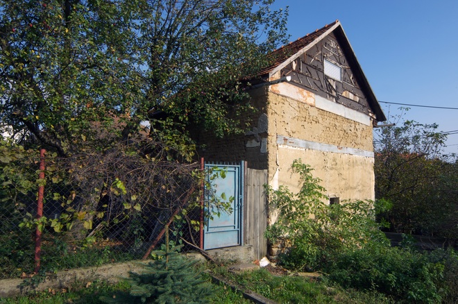
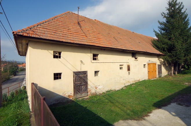
Folk architecture
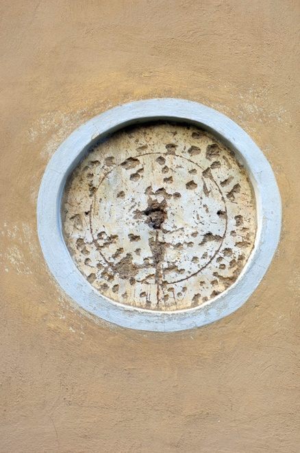
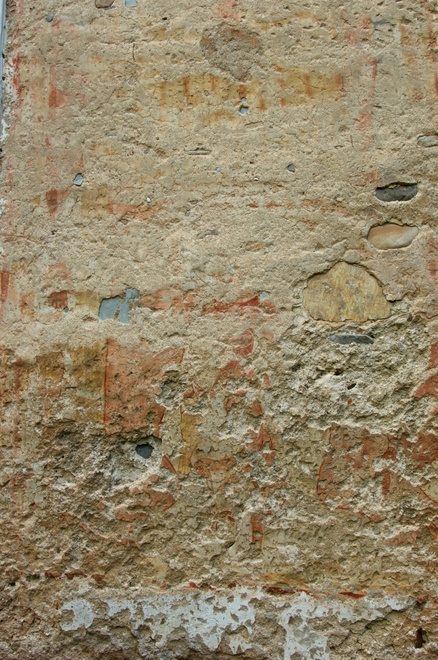
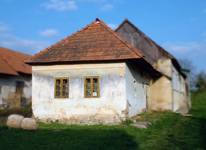
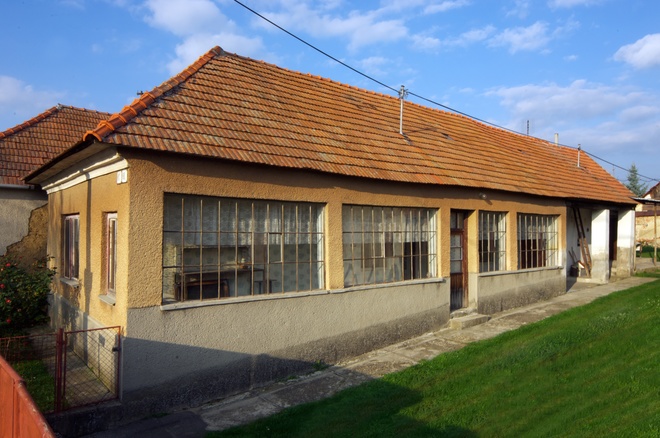
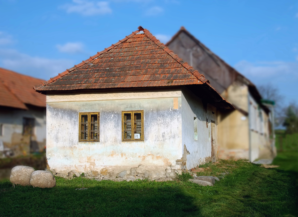
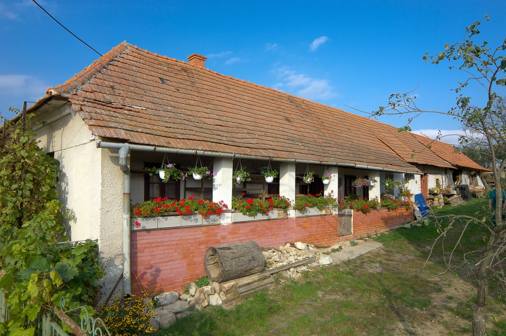
Traditional houses from the end of the 19th and the first decades of the 20th century with original details and façade decoration are known from a number of municipalities, but they have not been preserved in Velčice. Only the original ground plans and approximate shapes are preserved, the rest is gone with reconstructions in the 20th century. The houses are mostly built of rammed earth or sun-dried bricks and have stone foundations. The new facades and new windows have completely altered the appearance of the rectangular double- or triple-room peasant houses that were typical in this area. Long yards with agricultural structures were typical; sometimes the entering barn (pajta) has been preserved. Very often the houses stood at both sides of the court. Some of these yards with small rectangular building are now used as dwellings. The later stratum of dwellings in the municipality is now represented by hallway and veranda-type houses from the inter-war period.

Mills
Two mills outside the centre, on the Čerešňový Stream operated in the later 18th century. Today there are still to be found the remains of two other mills as seen on maps from the 19th century. North of the centre, on the other side of the stream, above the restaurant, there is a visible depression with the remains of the mill room of Mateffy’s Mill. The old miller’s house, next to which the mill room of the upper mill stood, is situated in the garden of house no. 150 in the K priehrade Street.

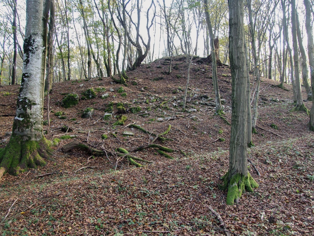
Castle
This small castle is situated on a hardly accessible place in the forest, on the north-east foothill of Svinec, above the Čerešňovým Stream. From the fortification with the measurements of about 56 x 115 m we can see today the rampart and the bailey. The elevated eastern part of the area has preserved the rests of the stone foundations of the tower (built on a rectangle of 6.5 x 7.3 m). The ruins of other buildings are to be found within the fortified area. The castle dates back to the 13th–15th centuries. Most probably it was connected with the deserted village of Kľačany.
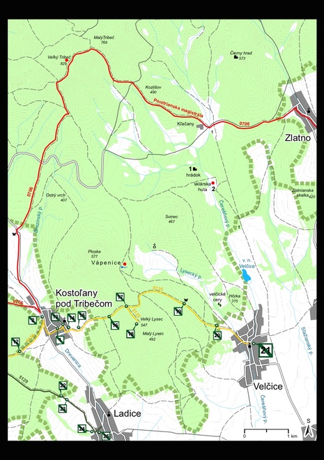

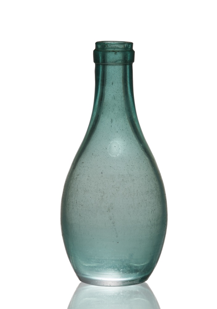
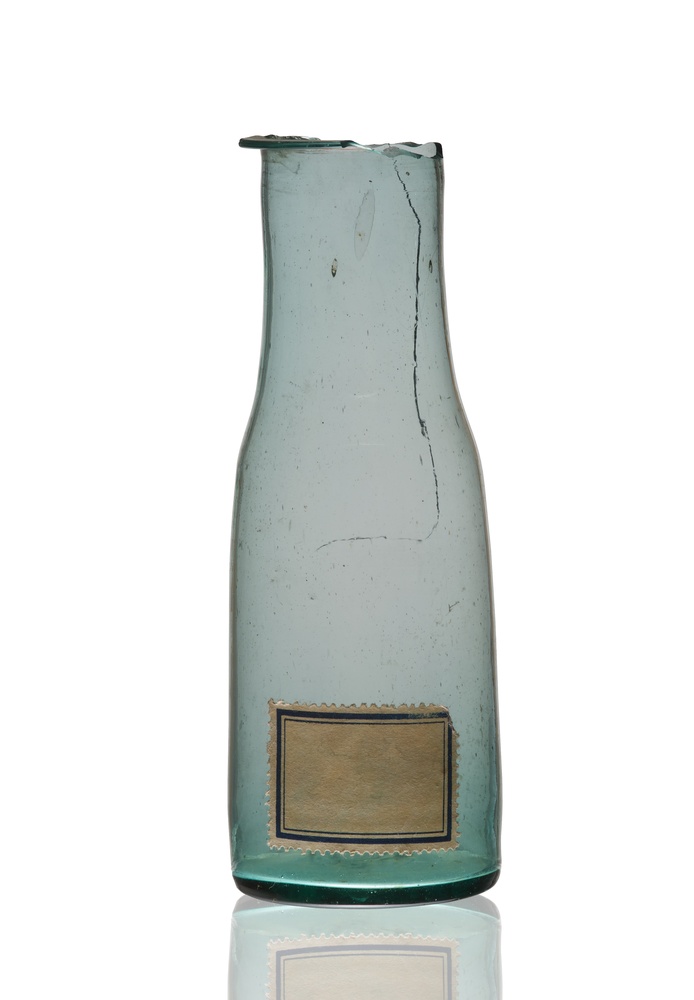
Glassworks
The area of the glassworks is still described as ‘glassworks’ on the maps and can be reached by a field road on the north-eastern border of Velčice, 500 m from station No. 21. First the road leads to the north, then to the northwest. 2.8 km from the pitch, on a crossing of forest roads on the border of the forest we turn left and after continue after 20 m to the north-west, about 900 m from the border of the meadow. Time: 1 hour, 10 min., length: 4.2 km from station No. 21, easy. We recommend that you take the same route back.
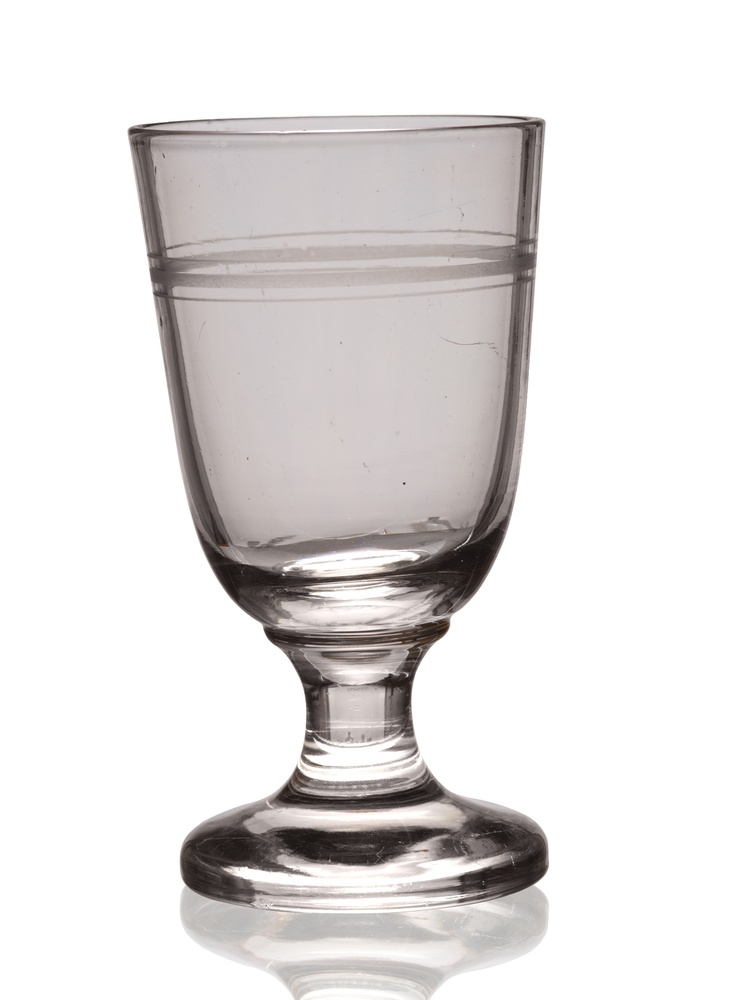
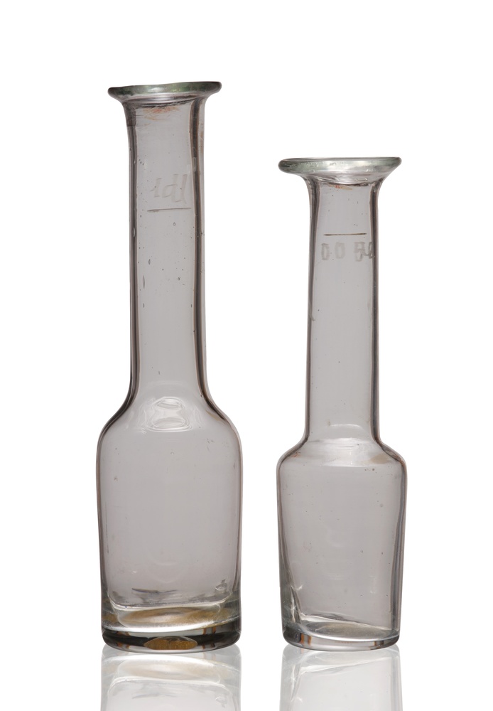
The glassworks at Čerešňový Stream seems to have been founded by the Forgács sometime between the 1830s and 1860s. According to contemporary maps the area consisted of 14 buildings, a part of which served as accommodation of the glass blowers. Later the glassworks was rented by the merchant Landkammer and then overtaken by the company Stolzer and Eckenberger as well as other less important tenants. The glassworks was operated until 1879. Fifty years back ruins of the kilns could be seen. They were pear-shaped and had diameters of about 60–70 cm at the bottom and a high of approximately 120 cm. According to the preserved records, oral tradition and literature, sheet glass was produced at one of them, the other produced sheer hollow glass as well as green glass and crystal ware. According to finds and their photographs glass was also blown into moulds here; rectangular flasks were made that were also used as glass inlays by local carvers.
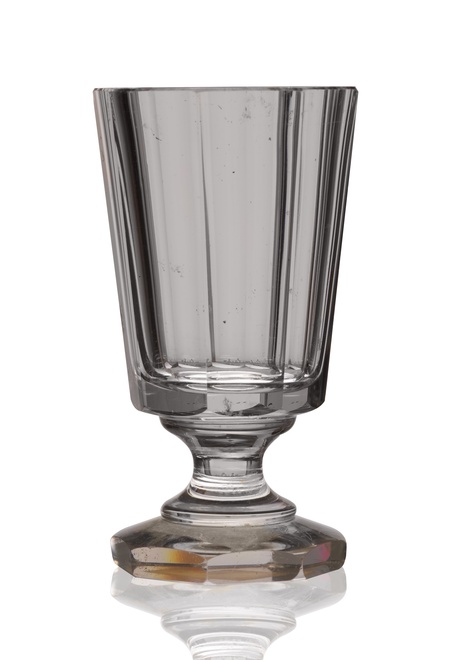
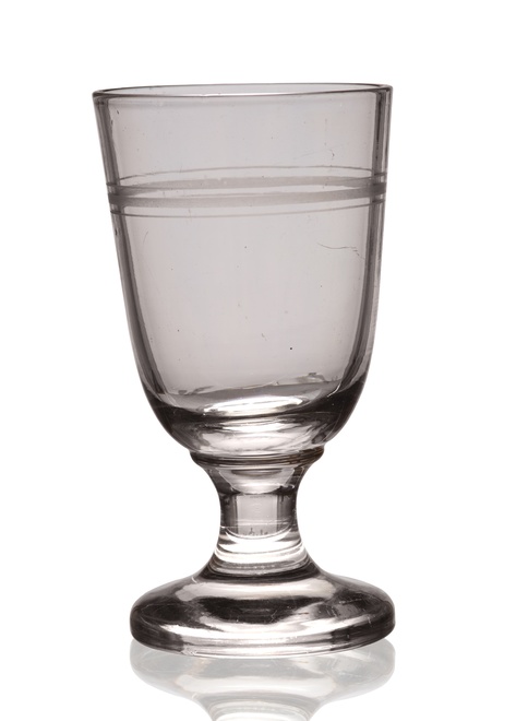
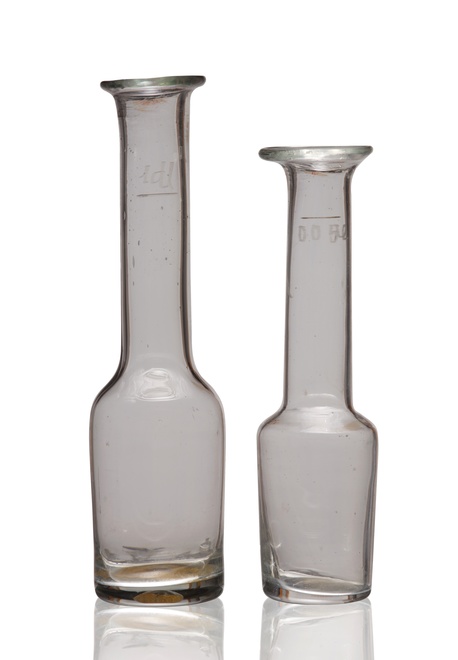
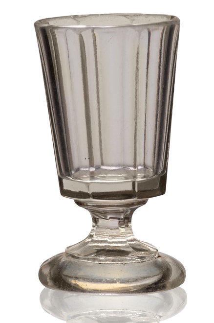
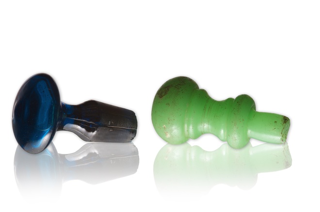


The better pieces were exported to Vienna. The workers came from Moravia, Bohemia, and Germany; but local glassmakers were employed here as well. Today the local history of glassmaking is known only from brief accounts, as for example from a list of donors of the pipe organ for the church in Velčice in 1877. A list of 21 inhabitants of the glassworks shows 13 German names. Many glassworks that could not keep pace with technical innovations on the glass market were shut down at the end of the 19th century. This seems to have been the case of the glassworks of Velčice as well. Even today one can find pieces of melted glass at the banks of the Čerešňový Stream.
Interesting events
Table tennis tournament, cup of the mayors of Mankovce and Velčice (April), Ascend to Lysec Mountain (8 May), and the ‘Football Cup of the Streets’ (September)