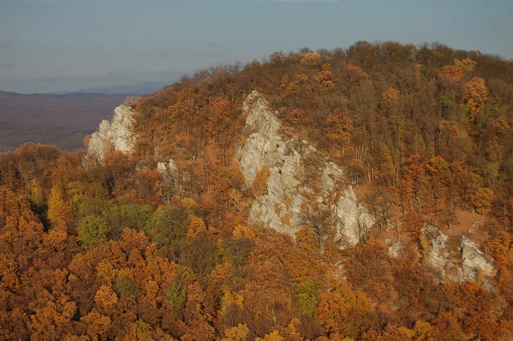
Veľký Lysec
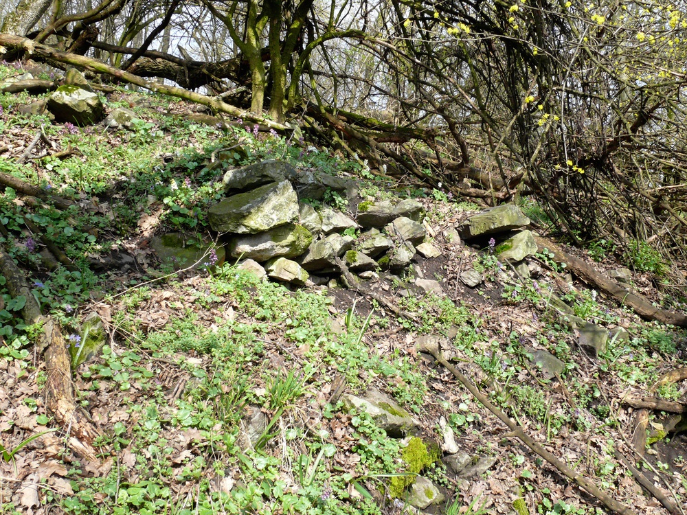
Station No. 18 is located on the northern edge of the Lusatian Culture hill-fort Veľký Lysec. The hill-fort dated back to the end of the Late Bronze Age and Early Iron Age (800–600 BC); it forms part of a line of fortifications located in this part of the Tríbeč Mountains. The hill-fort was a prehistoric castle that guarded the Kostoľany Basin and particularly the Kostoľany main road from Ladice through Tríbeč to the central Nitra region. The builders of the prehistoric castle took advantage of the physical relief of the promontory of Tríbeč that allowed building a complex with no greater obstacles; It was divided by fortifications into three parts: upper castle and two outer baileys.
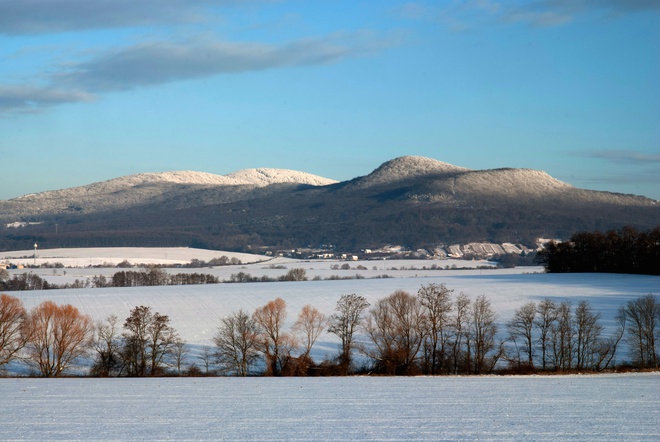
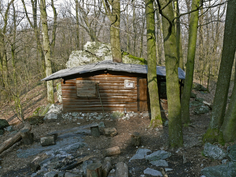
From Sedlo pod Lyscom we turn to the southeast to a ridge marked with trail blazes leading up to a viewpoint (yellow equilateral triangle on a white square of 10 x 10 cm). A narrow path with a slight and onward steeper incline leads to the foot of the rock walls where a log cabin shelter of the Slovak Tourist Club (Pustovník Sľažany), is located. From there, markings are to be found on the rocks; they lead very steeply to a viewpoint named Veľký Lysec, 547 MASL, where the trail ends (the endpoint is marked with a small yellow square on a white square of 10 x 10 cm). Time: 10 min., in the opposite direction 5 min.; length: 0.4 km, medium-challenging, challenging at the end. In the opposite direction be cautious in the rocky terrain! Note: The hill-top of Veľký Lysec marked with a triangulation post is forested and with no view.
The builders of the prehistoric castle took advantage of the physical relief of the promontory of Tríbeč that allowed building a complex with no greater obstacles; It was divided by fortifications into three parts: upper castle and two outer baileys.
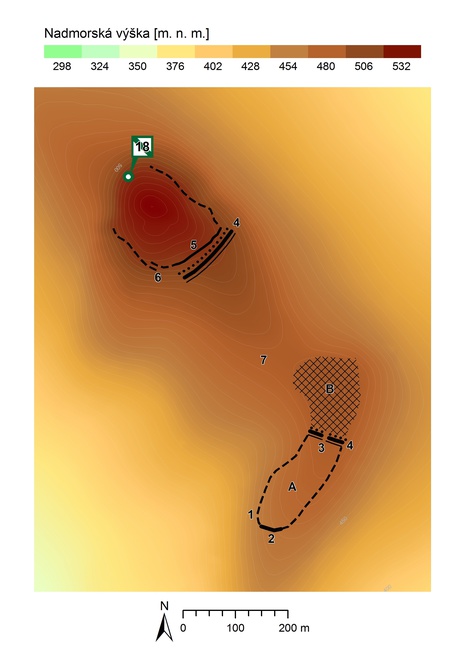
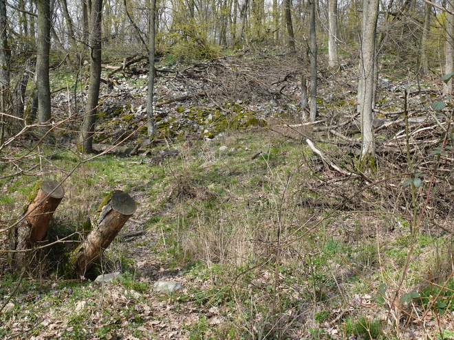
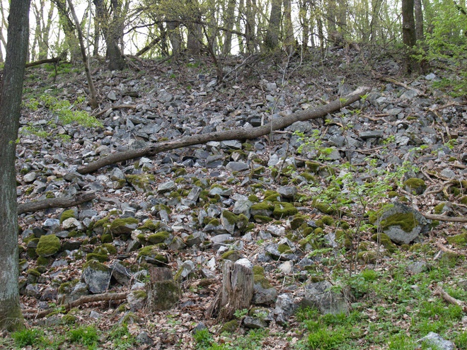
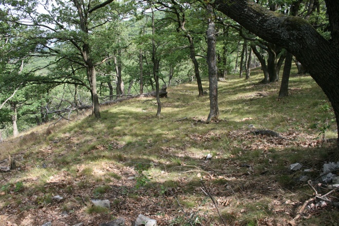
The upper castle lies at the top of Veľký Lysec, covers an area of about 2.3 ha and is protected by steep rocks on the northwest. On the remaining sides a rampart with stone wall on the front was erected. The remains of the wall are sporadically still visible on the southern edge of the castle and the destruction of the fortification gives the impression of a stone avalanche. The fortified area was interrupted by a semi-pincer gate, which was situated at the south-western corner of the fortification. The area of the upper castle was divided into several still visible artificial terraces. From the southeast, where the upper castle was the most assailable, a second – forward fortification line consisting of a ditch, a rampart, and presumably of a palisade protected this area.


The entrance to the upper castle was protected by two fortification lines that are visible on the ridge of Malý Lysec, which enclose two separate areas of the lower castle, the outer baileys. The entire course of the fortification line of both outer baileys is not yet known. The remains of burnt wooden buildings were excavated in the second outer bailey. In the saddle connecting Veľký Lysec and Malý Lysec are two depressions interpreted as water reservoirs. The archaeological research indicates that this settlement was related to surface mining of limonite. The functions of the individual parts of the prehistoric castle at Veľký Lysec are only suggested. In terms of knowledge of contemporary fortified settlements of similar type in Europe it cannot be excluded that the upper castle contained a cult place.
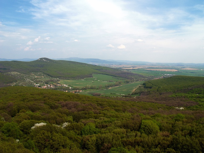
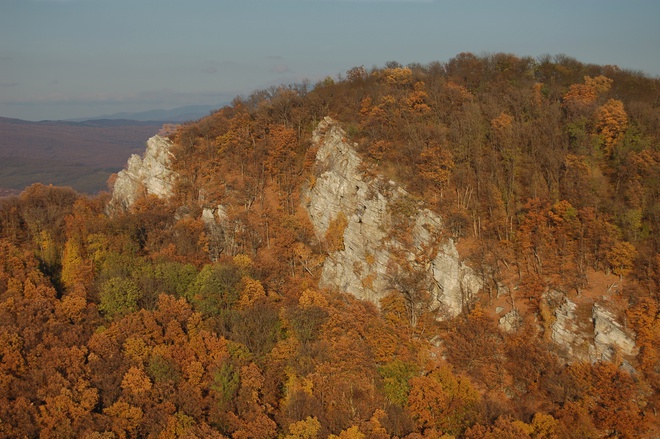
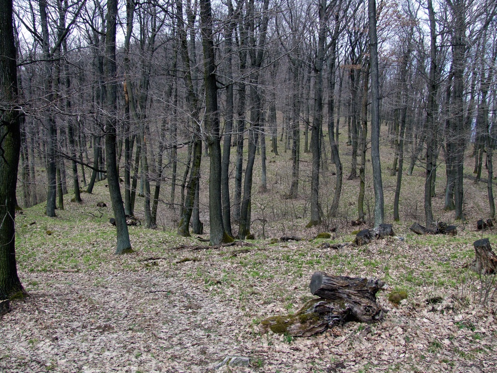
From the highest point on the tourist trail is a very beautiful panoramic view of the surrounding landscape. Straight beneath is the forested Sedlo pod Lyscom, where the ridge continues to the northwest, to the hilltop Ploská (576.8 MASL) and further to the steep slope of the highest point of the Tríbeč Mountains, Veľký Tríbeč (829.6 MASL).

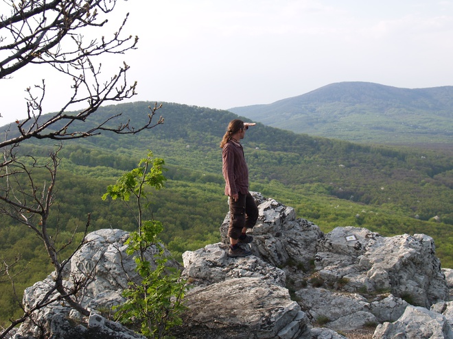
In the main ridge stretching from Veľký Tríbeč to the northeast it is possible to identify Malý Tríbeč (769.4 MASL), Medvedí vrch (719.4 MASL), Mišov vrch (722.6 MASL) and the dominant Javorový vrch (730.6 MASL), on which a wooden triangulation tower was standing still in the early 1970s. To the east, the slopes of Pohronský Inovec with Veľký Inovec (900.6 MASL) as their highest point are visible; to the west, the ruins of Gýmeš Castle are the nearest.
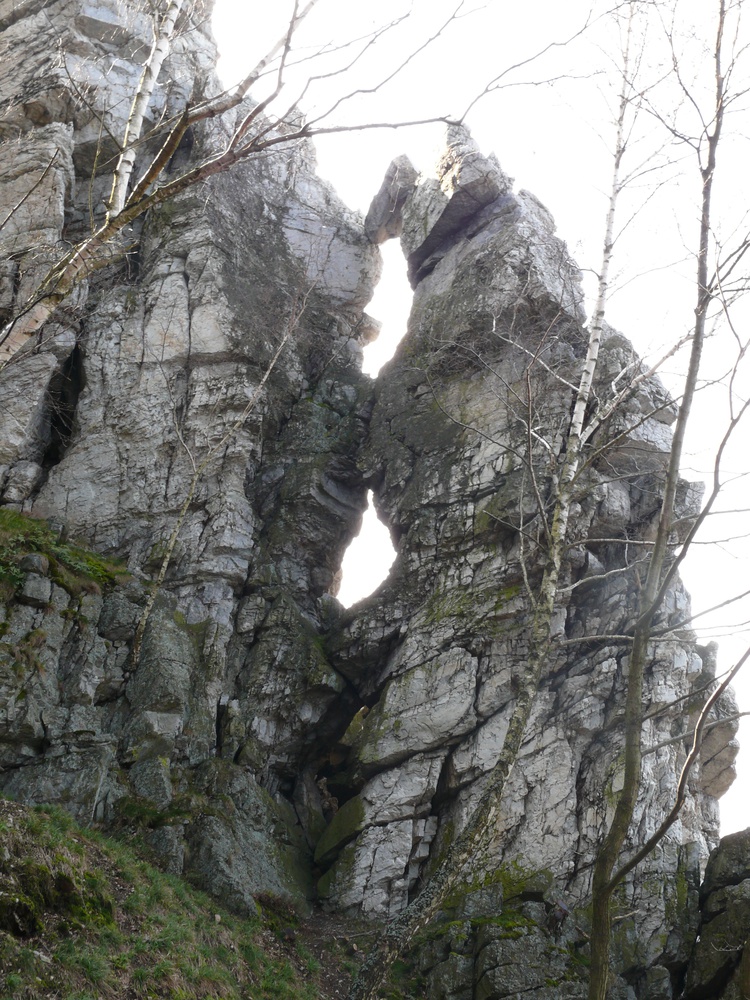
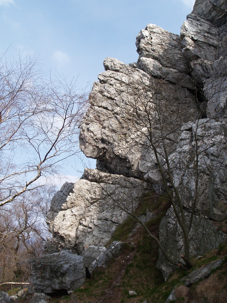
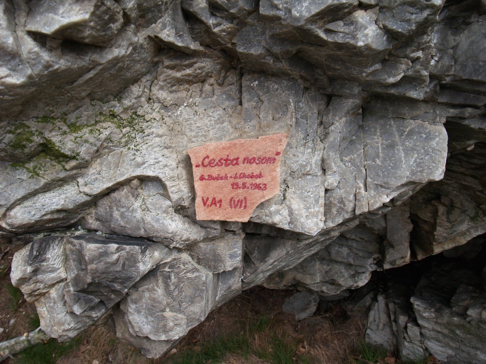
Among the rocky cliffs on the west of Veľký Lysec is a remarkable tower in the system of walls and blocks intersected with vertical cracks. Two rock holes are situated in its upper part. The upper rock hole is closed with a block of weathered and released bench of pale quartzite. The rock formations of Veľký Lysec provide excellent opportunities for climbing. The rock are firm and enable the highest level of climbing in the classification by the UIAA (Union Internationale des Associations d’Alpinisme). Therefore it is intended only for good rock climbers with knowledge of fixing on the exposed areas. Vertical areas or rock overhangs with good catches require the use of power and climbing equipment.

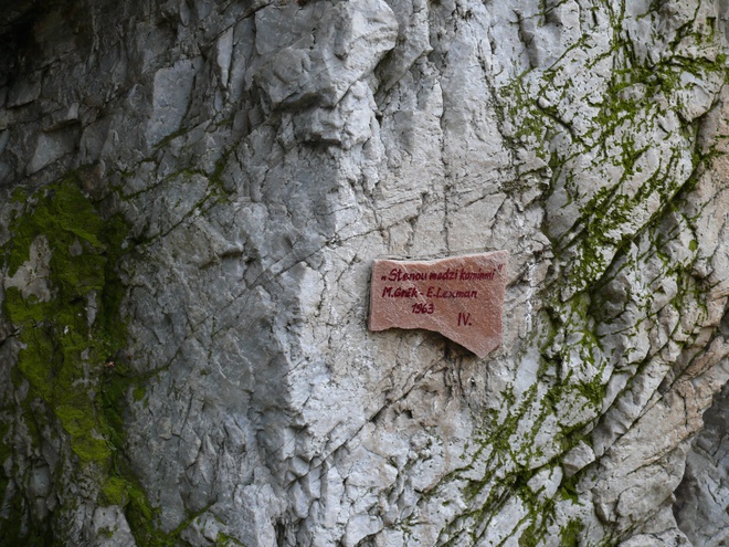


Rock climbers named the rocks and divided them into two parts. The western part consists of Hodinárska stienka, Hodinársky komín, Rozštiepená veža, Panelák, Panna and Galéria. The largest group of rocks in the north consists of Mackie Messer, Stred, Čierna stena, Kaplnka and Zadný jazdec.