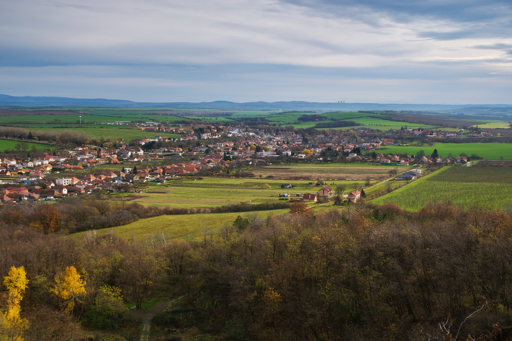
Municipality of Jelenec
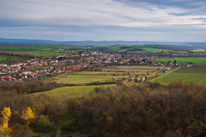
The municipality stretches over the Jelenský Stream valley; it is mainly situated in the hill land of Žitava. The northern part of the suburb lies in the uplands of the Tribeč Mountains. The centre has an altitude of 192 MASL; the quartzite peak Dúň (513.8 MASL) represents the highest-most point of the 2,718 ha community.
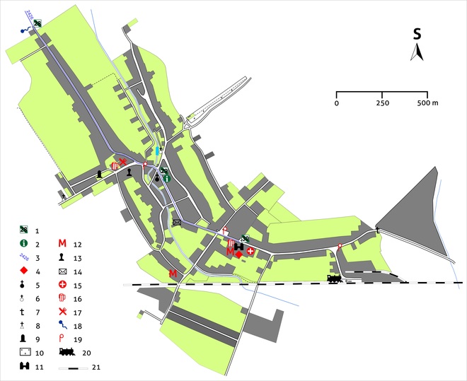
From station No. 28 we continue on an asphalt road, following the blue marking (2426) out of the municipality. The marked trail is descending at its end and after a turn to the left we arrive at the tourist signpost with the local designation Jelenec, bus in 198 MASL; parking opportunities.
Time: 20 min., in the opposite direction 20 min., length: 1.5 km, easy.
- contents:
- Jelenec until the end of the 17th century
- Jelenec in the 18th–19th centuries
- History of the municipality in the 20th century
- The historical names of Jelenec
- Urban development
- Gýmeš until the end of the 19th century
- Changes of the municipality in the 20th century
- Industrial and production zones
- The brickworks of Gýmeš
- Architecture
- Church of the Cross
- Small architecture
- Folk architecture
- Mills
- Jewish prayer house
- Famous sons and daughters
- Museums
- Tribečské múzeum minerálov
- Interesting events
2012 people settled in the municipality in 2013, about 63 % of which were of Slovak nationality, 37 % were Hungarian. The prevailing part of the inhabitants is of Roman-Catholic faith.
Brief history of the municipality
Jelenec until the end of the 17th century
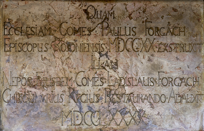
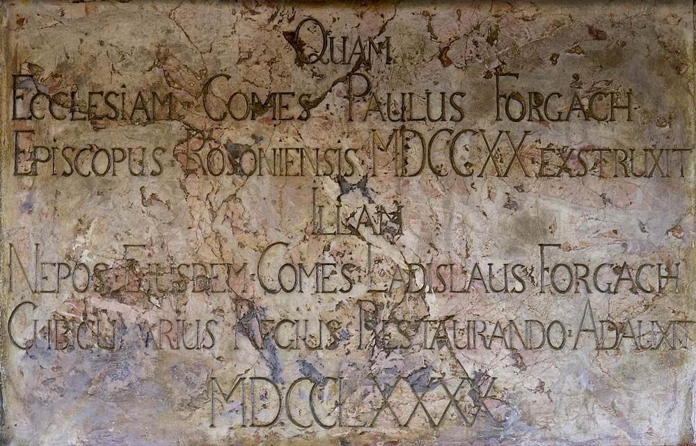
The territory of the municipality was settled already at the time of Baden Culture in the Eneolithic (about 3400–3100 BC). The first written records of the municipality of Jelenec, until 1948 called Gymes, stem from the second Zobor deed of 1113. By then Jelenec formed part of the property of the royal castle of Nitra. Count Andreas, the founder of the Forgach Family, after having erected Gymes Castle in 1242–1253 (station no. 7), he came into possession of the territory of the current municipality. By then at the latest Studený hrad must have been built (station no. 10). After 1303 the domain of Amdreas’s sons must have been overtaken by Matheus de Terench. After his death the Gymes property came under royal administration. In 1350 Veľký Gýmeš was granted the right to hold a weekly market by King Louis I of Hungary (1342–1382). In 1386 the Forgács became once more the owners of the dominion of Jelenec. According to an inventory of the Forgachs’ possessions from 1525 the small town of Jelenec was inhabited by a mixed Hungarian and Slovak population with Hungarian majority. The town was sacked by the Turks in 1530, 1576, 1663, and 1671. About 1550 the Forgachs were influenced by the reformation and turned to Protestantism. The Gymes Church war returned to the Catholics in 1623 as a subsidiary church to the Ladice parish.
Jelenec in the 18th–19th centuries
After the defeat of the rebellion of Francis II Rákóczi, on whose side also Simon Forgach fought, the dominion of Gymes came into the possession of the Hungarian chamber. The confiscated property was regained by a distant relative of Simon, by Bishop Pavol Forgach in 1718. In 1726 the right to hold a market in Gymes was renewed.
In 1787 there were 138 houses and 1,023 subjects in Gymes. In the first third of the 19th century Gymes had apart from the mills three meierhofs and a quarry. One of the first Slovak sugar refineries was operating in Gymes between 1832 and 1852. In the course of the 19th century a number of diseases struck Gymes (in 1831, 1849, and 1866). Since 1880, there has been a post office in Gymes; and twelve year later Gymes referred to itself as ‘town’ for the last time.
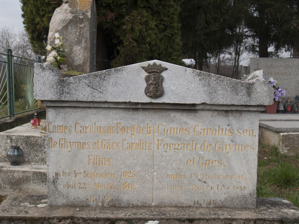
It remains unknown when the first school in Gymes was founded. According to archival records, there were 63 pupils in 1842. In 1885 the municipal school became a state school. It was situated in the Kostolná Street. The first fire brigade appeared in 1898. The fire station also contained a prison cell. In 1890 there were 1,081 ihabitants in Gymes, 894 Hungarians and 187 Slovaks. In the 19th century the hunting ground of Gymes was famous all around Hungary for its hunts of big game, fallow deer and mouflons (station no. 19). Especially Karol III Forgach (1825–1911) was engaged in breeding deer.
History of the municipality in the 20th century
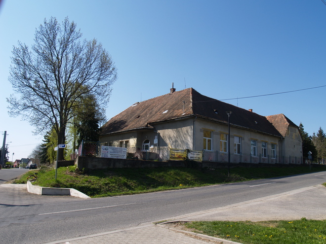
At the beginning of the 20th century a new school with three classes was erected (1912). In 1919 the Forgach Family moved away from the municipality. In 1930 the municipality was electrified. The railway station was finished in 1938. The Forgachs’ property was confiscated after the Communist coup in 1948. An agricultural cooperative was founded soon after (1951). Various public buildings stem from the 1960s and 1970s: the recreational facility of Autocamping (driving and camping) Remitáž, a new school building, the Nový život Cinema (1960), a medical centre (1966), a new parish (1971), a football stadium (1976) and the house of mourning (1978).

The historical names of Jelenec
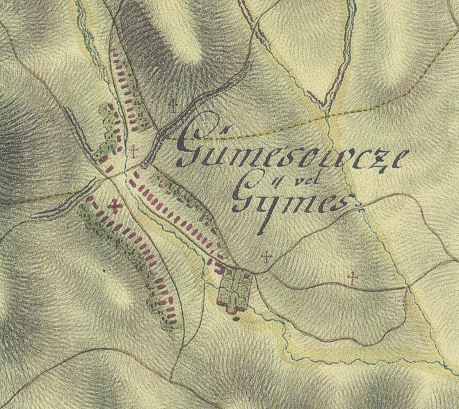
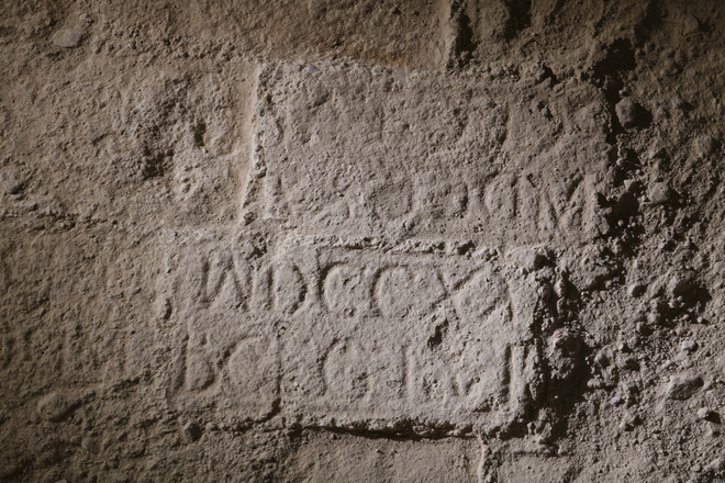
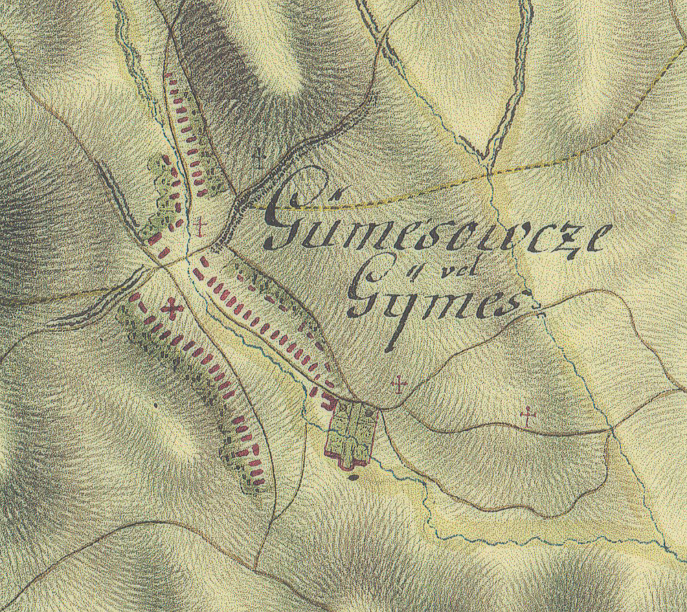
The historical names of Jelenec The municipality is attested under various designations in the written sources: Gimes** (1113), Guymes (1232), Gymus (1253), Gyemes (1356), Gymes (1531), Ghymes (1773), Dýmeš (1920), and Jelenec* since 1948.
Urban development
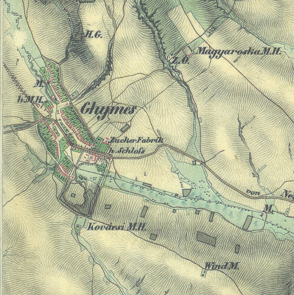
Gýmeš until the end of the 19th century
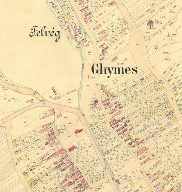
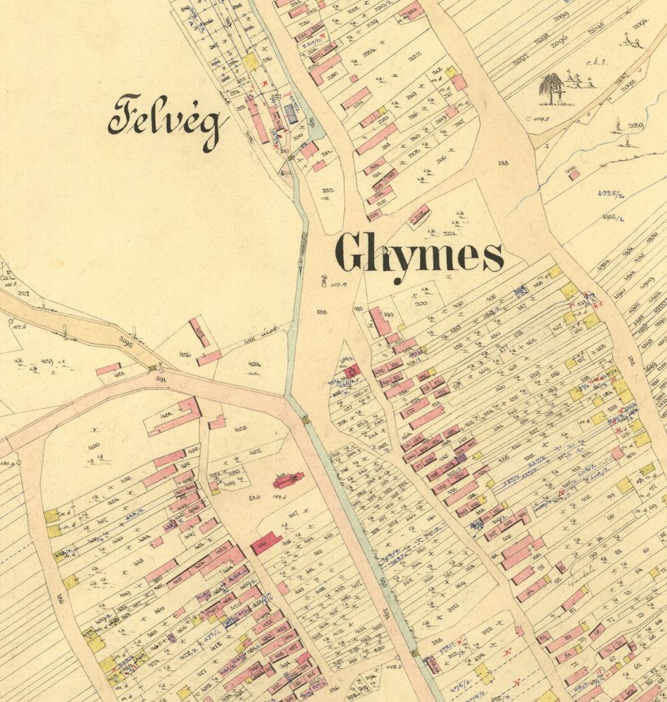
The oldest records of the settlement structure of the territory of Gýmeš is to be found in a deed from 1295, which mentions the settlements Horný and Dolný Gýmeš (Upper and Lower Gýmeš) as divided by a forest and the Kišfalud settlement. Today, the historical kernel of the municipality’s road net can be deduced from the streets Horný koniec (Upper End), Dolný koniec (Lower End) and Čaládka. The route and shape of the streets was determined by the course of the Jelenský Stream and the crossing of the road from Nitra to Hronský Beňadik and the road connecting the Požitavie with Ponitrie across the Tribeč mountains.
The Church of the Holy Cross and its cemetery, which has remained the municipality’s natural centre and is accessed by the Kostolná ulica (Church Street), has been erected in the 14th century at the latest. The medieval urban structure was preserved at least until the 18th century; in 1722 Bishop Pavol IV of the Forgach Family has had built a Baroque manor house with husbandry yard and a large park. The new road to the castle across Horný koniec along the vineyards to Bielý kríž gained importance in connection with the modification of Gýmeš Castle and the boom of viticulture. At the end of the 18th century, the church cemetery was abolished and a today’s new cemetery established.

In 1832 a sugar refinery was established north of the Manor house. Already before 1843 the mill island started to developed in the western part of Horný koniec and the floodplain of Jelenský Streat at Dolný koniec started to be built up.
Changes of the municipality in the 20th century
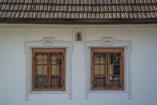
The extent of the built-up area of the municipality centre remained unchanged until the end of the 19th century. In the 20th century, especially after 1945, buildings in the historical centre became dense, new housing quarters were established at the roads in the outskirts, including the area of the manor house park (Šumina, Potočná and Brezová streets, eastern fringe of the Hlavná Street, partially as well Staničná and Mariánska Streets). The former road to the gamekeeper’s house Remitáž became the new Nový Gýmeš Street.
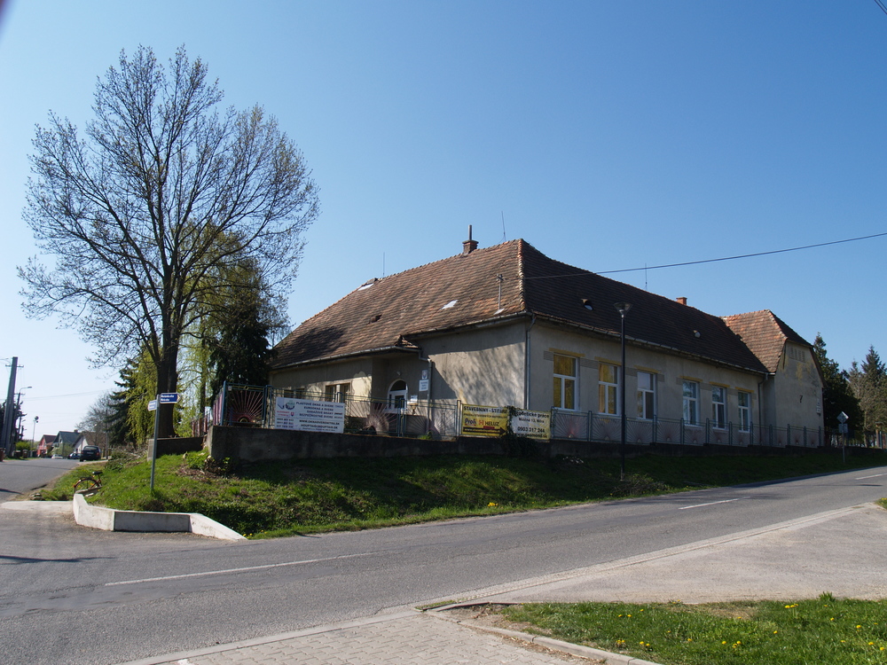
A new school building was opened in 1960, and not much later the Školská (School) Street was called into being. New family houses emerged especially in Slnečná (Sunny) and Smreková (Spruce) Street. A culture centre combined with a municipal office, register office and library was built in 1991.
Industrial and production zones
We still do not know the exact location of the main Meierhof of the Forgács, which is refered to in an inventory of Gýmeš Castle from 1647 and which supervised the Meierhof Jedliny in Kostoľany pod Tribečom.
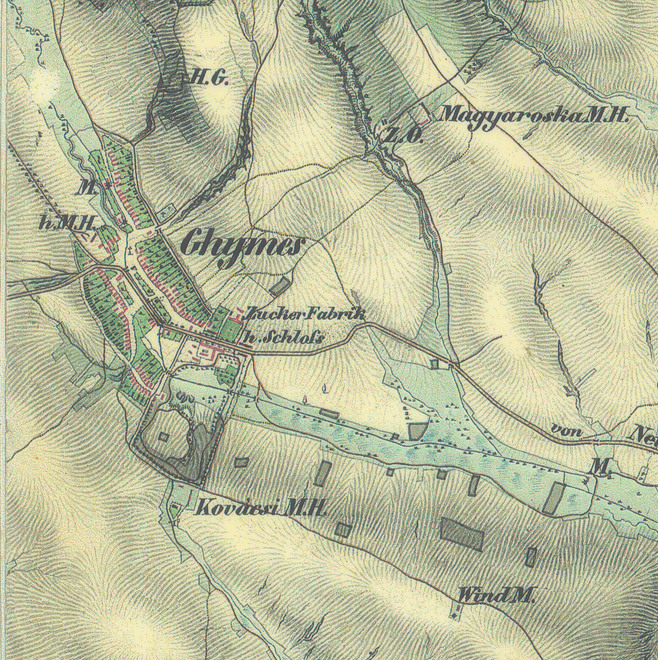
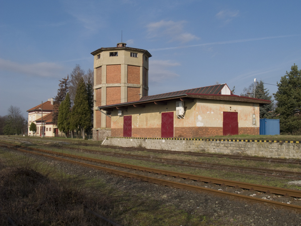
In 1752 five lime kilns are referred to as situated within the municipality. In the 19th century there was a Meierhof Moďoróška, Kováče and the Meierhof originally situated at the entrance to today´s Gaštanová. The tradition of Forgács Meierhofs and a brick works was followed by a brief era of sugar manufacturing after 1832. The construction of the railroad between Zbehy and Zlaté Moravce in 1936–1938 represents a milestone in the development of the industrial zone in the south-eastern part of Jelenec. One of the most outstanding buildings of the municipality is the water tank at the railway station. A factory, producing parquets until 1958, and a sawmill were erected at the station. In 1956 a quarry was opened at Plieška, which quarried stone for the Kovohuty Istebné factory.
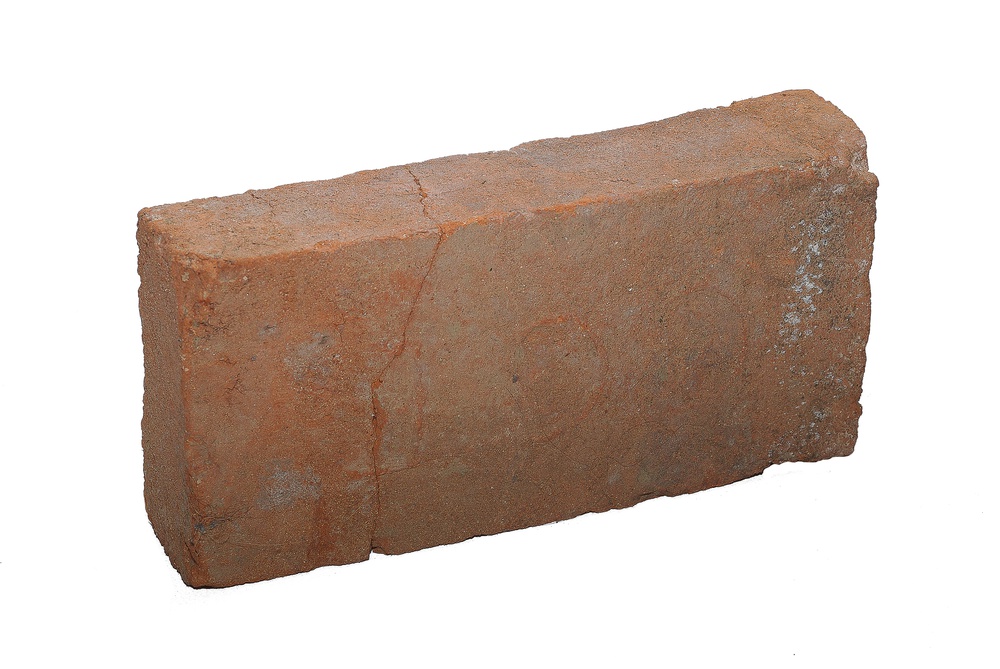
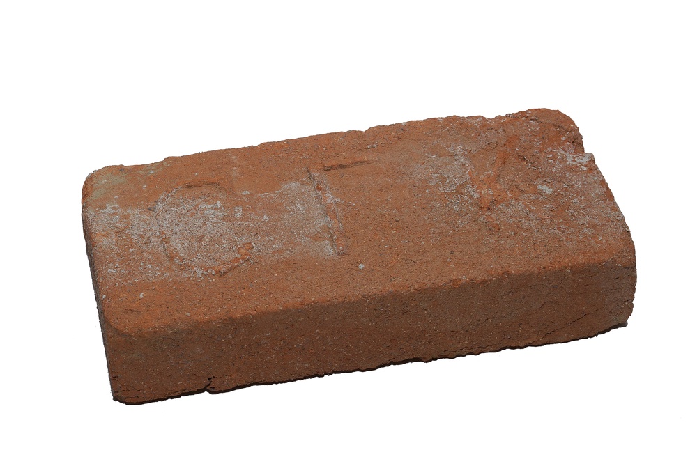
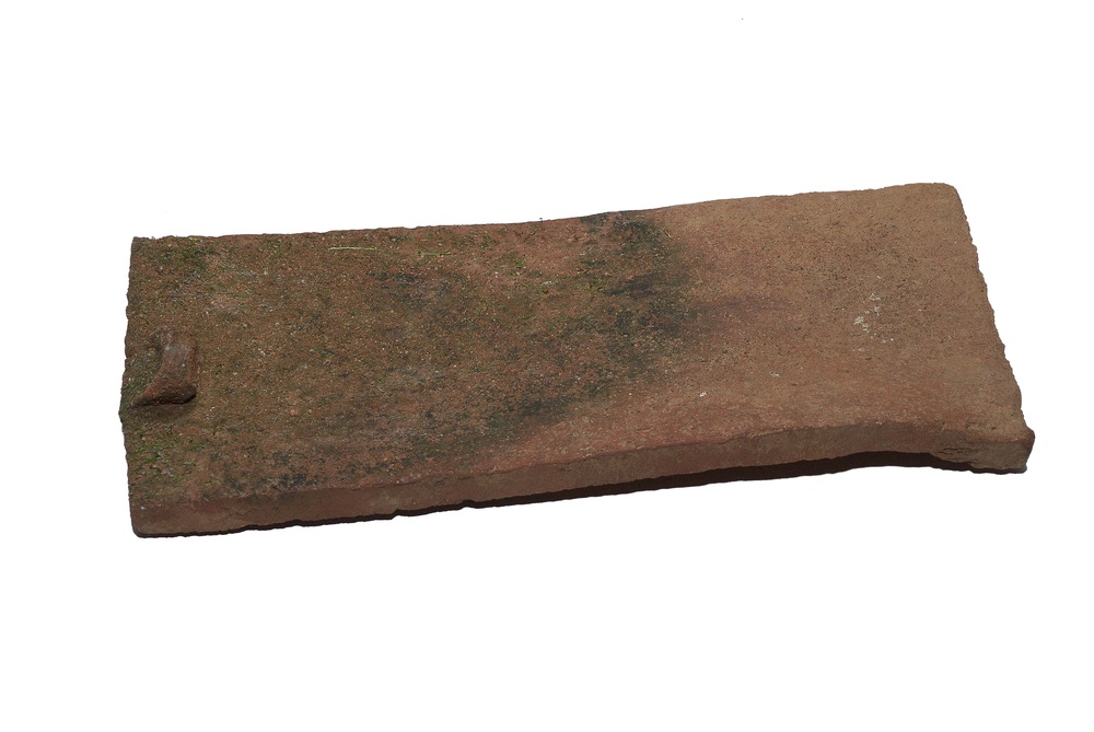
The brickworks of Gýmeš
The Forgach family had a number of large buildings erected on their Gýmeš property, for which they used bricks from their own brickworks. Among those buildings we have to mention the Baroque renovation of Gýmeš Castle at the first place, the Forgács’ manor house in Gýmeš and the reconstruction of St George’s Church in Kostoľany pod Tribečom by Pavol IV (1677–1746) and Pavol V (1696–1759) of the Forgach family in 1713–1755. In the 19th century the brickworks of Gýmeš was situated near the Meierhof Moďoróška, north-east of the municipality’s centre. Apart from historical maps this is proved by large surfaces covered with brick waste.


Architecture
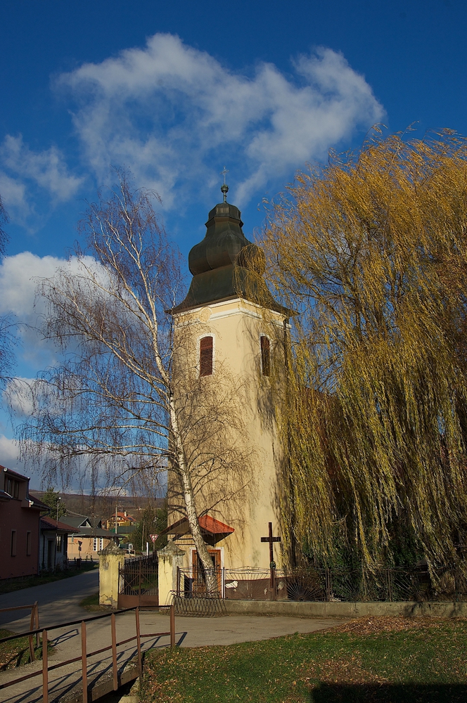
Church of the Cross
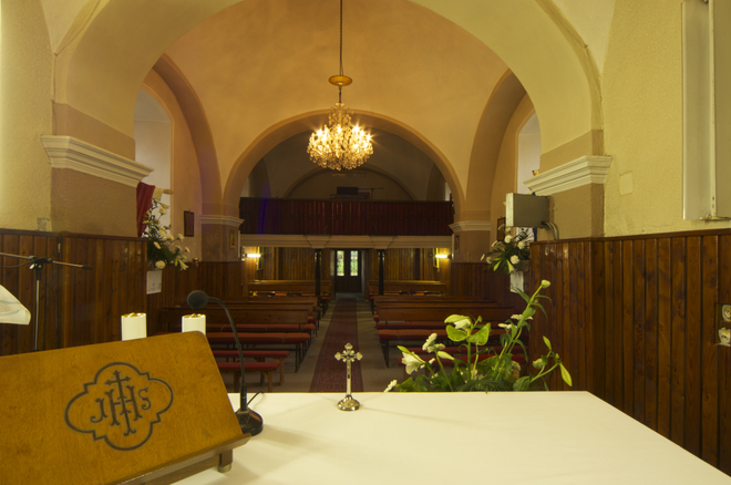
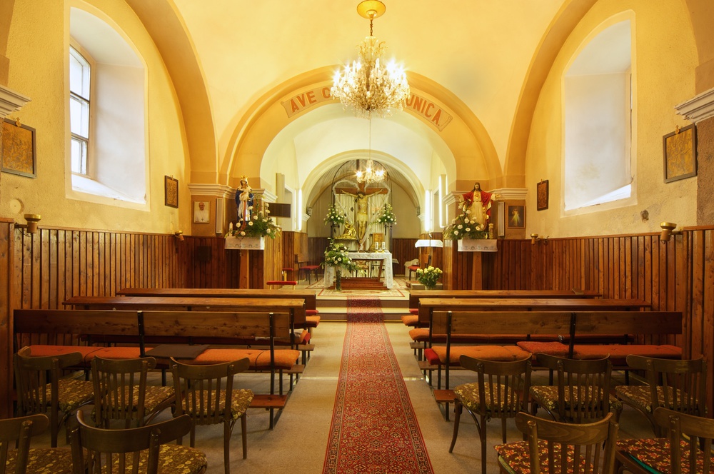
The church founded in the 13th–14th centuries was rebuilt in 1720 and 1790 in the Baroque style; this renovation was initiated by Bishop Pavol IV of the Forgach Family and his grandson, the chamberlain Ladislav Forgach. At that time the church took its current shape with single-nave and prolonged sanctuary, with a sacristy and an annex for the family tomb of the Forgach. Only the medieval tower and a part of the aisle have been preserved from the originally Gothic building. In 1950 a south annex to the presbytery was added and the current ground plan developed into the shape of the Latin cross. In the course of the general renovation of the church in 1974, the Forgachs’ tomb was refurbished to a sacristy and their remains buried at the local cemetery. At the same time, the Baroque façade decoration was removed. All outer walls were plastered with a mineral finish (brizolit) and the church yard encircled with a fence with concrete foundation wall and two gates.

The interior of the church has preserved its predominantly Baroque appearance in all ways. The aisle is structured by wall pilasters carrying two bays of Prussian vaults. The presbytery shows a surbased dome and Prussian vaulting, the eastern end has an opening to the tomb of the Forgach family, today’s sacristy. The Baroque equipment was replaced with a modern one, mainly from the second half of the 20th century

Small architecture
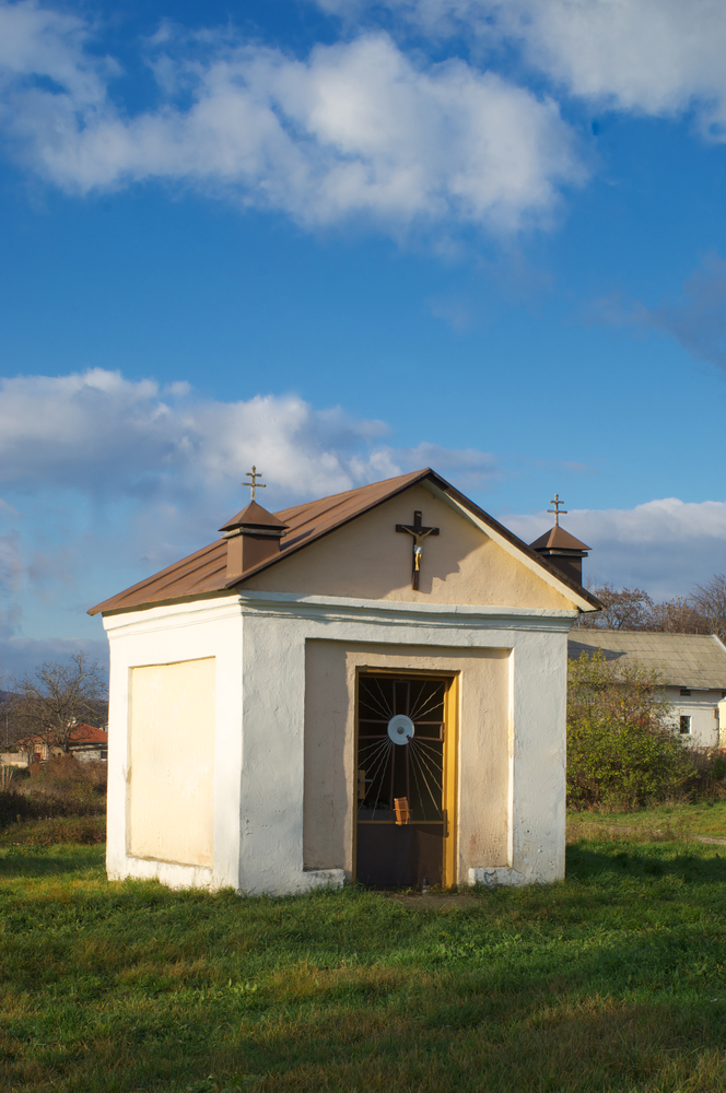
The chapel of St John of Nepomuk from the end of the 18th century is situated on the entrance to Horný koniec (Upper end). A Pietà from the beginning of the 20th century on an older stone pedestal stands on the western border of the municipality and a statue of St Urban is to be found in the vineyard.

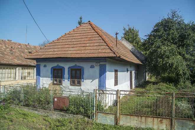
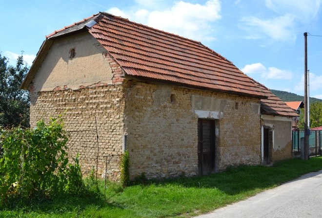
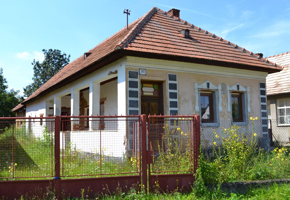
Folk architecture
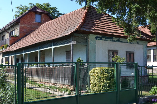
Folk architecture has been preserved only from the end of the 19th and beginning 20th century; it is characterised by traditional single-winged oblong houses with six rooms, often connected with an outbuilding. The houses are situated in the front part of the premises, the gables transversally to the street. At the beginning of the 20th century most of the houses were built of various materials, of burnt and unburnt bricks. The interwar period saw the erection of hallway or veranda houses. Geometrical divisions and geometrical decoration was applied on the street façades, sometimes even plastic decoration around the windows. Often the street façades had niches for statues of saints on the street side. Among the preserved agricultural buildings we should mention the barn of house no. 504 and a silo in Dolný koniec.

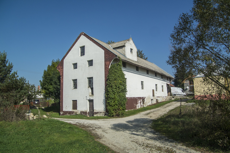
Mills
The first written records of a mill in Jelenec stem from 1663. At the end of the 18th century a water mill at Remitáž is attested. Before 1850, apart from the mill at Remitáž additional two mills were operating in Horný koniec and one was situated in the eastern part of the cadastre south of the road to Neverice. A technical curiosity is represented by the wind mill in the southern part of the cadastre. From these mills only the one in Horný koniec is preserved; it was built sometime before 1950 on the place of an older mill from the 19th century.

Jewish prayer house
Jews are attested since 1851; in 1877 they had a prayer house erected in the centre of the municipality. The Jewish cemetery was situated at the place of today’s football stadium.
The Forgach manor house (station No. 30), Studený hrad (station No. 10), and the remains of Gýmeš Castle (station No. 7) are among the most important other sights.
Famous sons and daughters
Šarlota Hevessy (1897–1981) Famous Hungarian-writing poetess and University teacher
Ivan Brauner (1907–1967) Scholar, famous veterinarian; among others he has participated in the discovery of a serum against swine fever.
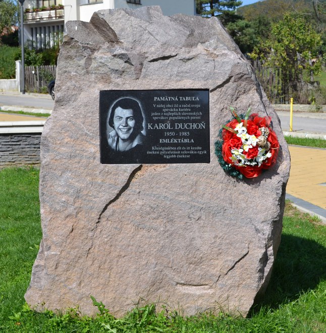
Karol Duchoň (1950–1985) This famous Slovak singer spent part of his childhood in Jelenec. Here he founded his first rock band, in which he was lead singer and guitarist. A commemorative plaque in the park at Mariánská Street reminds of him.
Museums
The Museum of the Forgach Family
The historical exhibition concentrates on the history of the Forgach Family
The ethnographical collection of Csemadok, the Hungarian Social and Cultural Association of Slovakia is exhibited as well
Hlavná ulica, Forgáčov dvor, 951 73 Jelenec
Tel.: +421376313311, +421376313204
E-mail: [email protected]
Opening hours: WED, SAT, SUN: 1:00–4:00 p.m.; guided group tours after prior notification also outside the opening hours
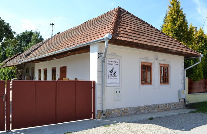
Tribečské múzeum minerálov
Private collection of about 350 minerals mostly from Tribeč and the vicinity of Nitra operated by the civic association mineralium.sk Čaládka no. 309, 95173 Jelenec Tel.: +421948099555
Interesting events
Folk festival (June), the mayor’s football cup (July/August),
Pilgrimage to Gýmeš Castle (July/August) In 2010 the traditional pilgrimage to Gýmeš Castle on the day of St Ignatius of Loyola, the patron saint of the castle church, which was founded by Bishop Pavol V of the Forgach Family in 1734, was renewd by civic association ‘Forgach de Ghymes’ in cooperation with the Municipality of Jelenec, the Jelenec parish and the Hereditas Patrum Association from Topoľčianky. At this occasion, Mass is celebrated and the so-called shovel dance performed, at which every pilgrim is welcomed with four blows of a shovel on his back.
The event has always been a part of the harvest festivities. It is not an organised pilgrimage; the castle may be entered individually and from various directions.