Trail Marking
Station no. 9 is situated on a former crossing of old roads to Gýmeš Castle from Jelenec, Kostolany and Ladice. Beginning with the 1930s, the Klub československých turistov (Czechoslovak Tourist Club) in Nitra in Zlaté Moravce gradually transformed the 13th-century road system in this part of Tribeč, which was related to the castle, into tourist trails with markings. The trail led the tourists to the pond at Remitáž, to the chestnut garden below Gýmeš Castle and to Gýmeš itself. The interest of the then forest owners played a role as well; they had shelters built for the wells, benches, feeders for the game and raised hides.
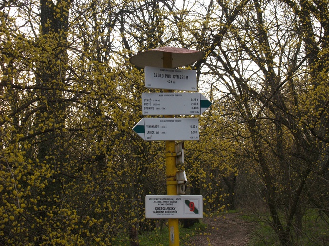
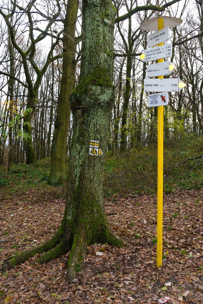
From the meadow (station No. 8) we follow, slightly descending, the green marking (5129), crossing a forest on the crossing with the yellow marking (8135); signpost Sedlo pod Gýmešom, 424 MASL. Time: 7 min., in the opposite direction 10 min., length: 0.6 km, easy.
Development of trail marking in the neighbourhood of Jelenec and Kostolany pod Tribečom
In the 1950s the longest tourist marking of Tribeč, the Nitra arterial (Ponitrianska magistrála), was created. In accordance with the rules of long-distance trails it was marked with a red stripe marker. The oldest part from Nitra to Veľké Pole first had no official name, however the designation ‘Pohorím Tribeč’ (Through the Tribeč Mountains) was in use. The route had a length of 70 km and took 22 hours and 15 minutes. The designation Ponitrianska magistrála (Nitra arterial) has been in use since 1981, when the red-marked route 0810 crossing the ridge of Vtáčnik and leading to Handlová was added to the original tourist trail no. 0706 from Nitra to Veľký Poľ. Today the whole Nitra arterial from Nitra to Handlová is 106.2 km long; apart from it, additional, shorter tourist trails were created in Tribeč. From Jelenec to Horné Lefantovice led the 13-km blue route and from Ladice to Oponice the green marking with its 18.5 km, which was shortened to 3.2 km in 2013. From Remitáž to Kostolany pod Tribečom and Velčíce leads the 10.8-km-long yellow marking.
Trail Markers
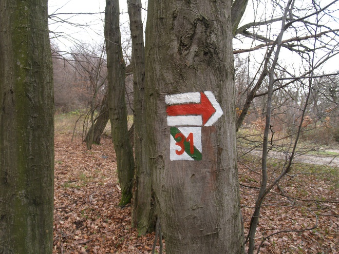
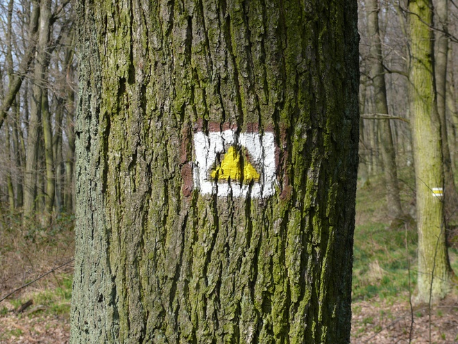
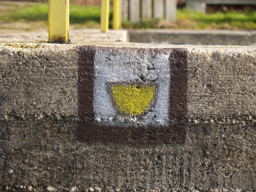
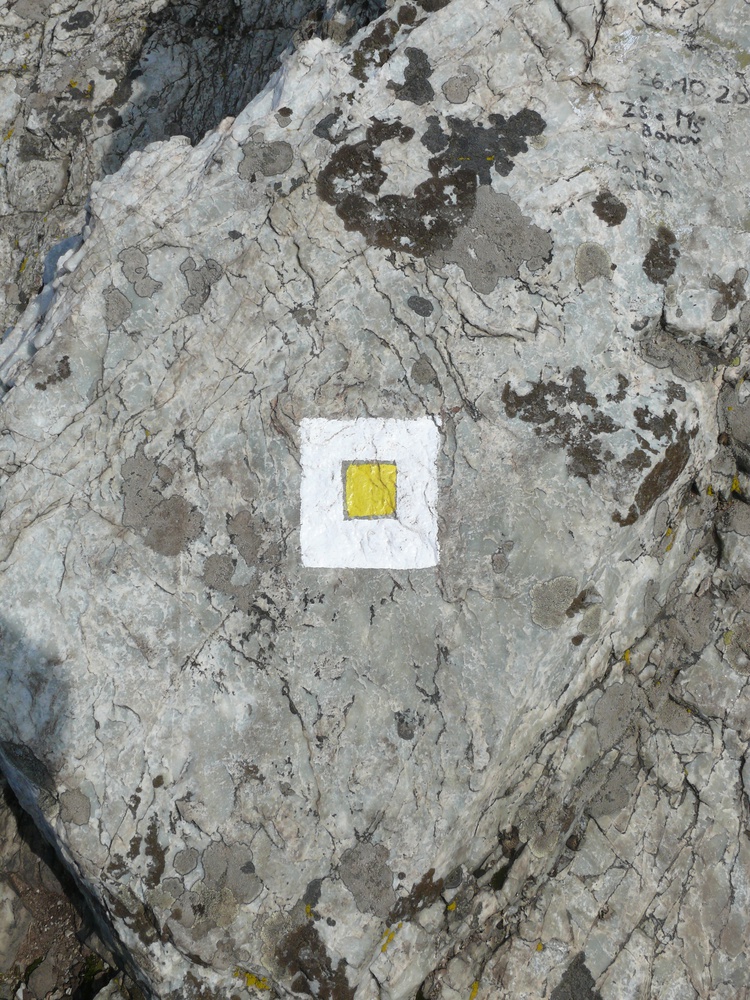
The Kostolany Educational Trail makes use of already existing tourist routes, which are distinguished according to difficulty by colours. The basic shape is a square of 10 cm on each side. It contains two white stripes on the edges and a coloured stripe in the middle that can be red, blue, green or yellow. If a coloured triangle is added to the square, bordered by two white stripes it is an arrow pointing to an unexpected change in the direction of the marked trail.
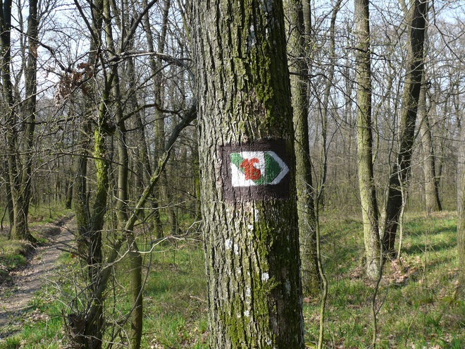
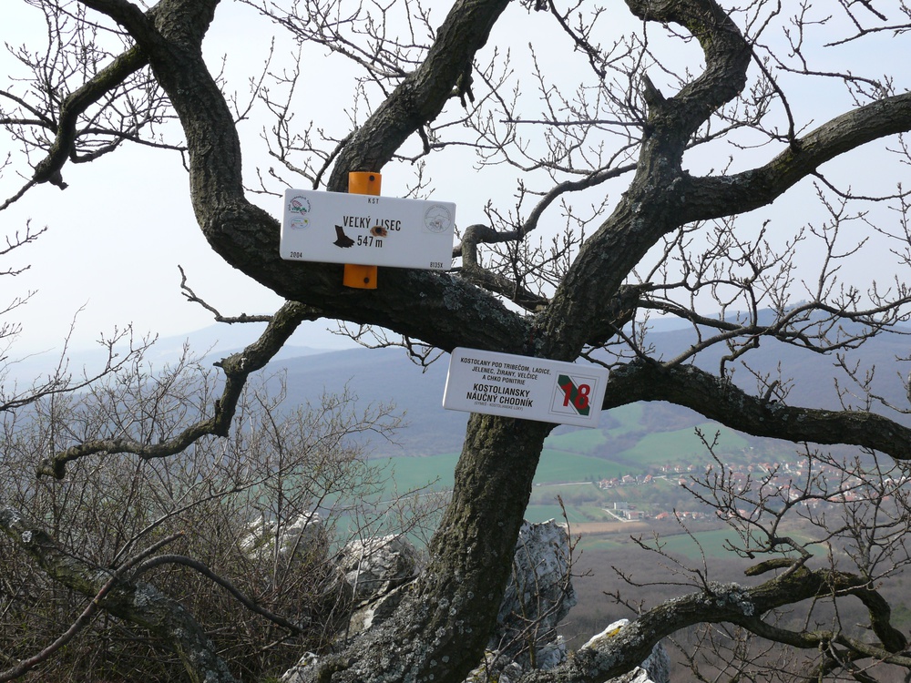
Apart from these stripe markers, there are markers with the symbols of important tourist sites in the centre (viewpoint, castle ruin, well, cave). To these belongs the unified symbol for educational trails with a diagonal green band, alternatively with the number of the station.
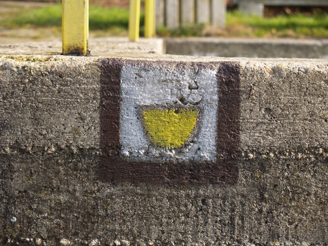
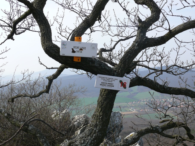
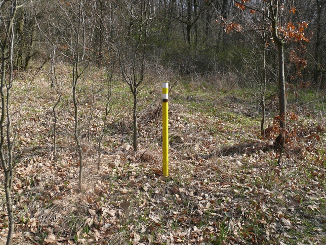
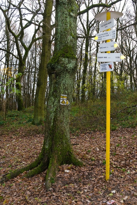
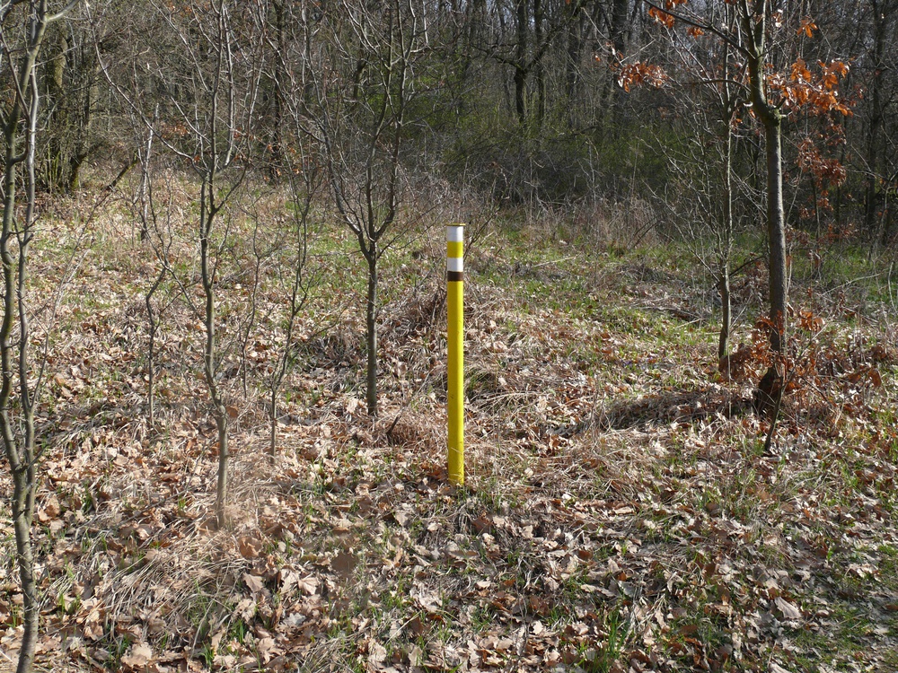
Markers are placed on suitable objects, on tree trunks in the forest, iron poles on meadows and on concrete pillars within municipalities. The trial network is added by tourist information elements such as sheet boards and destination signs on iron signposts.

The tourist marking is taken care of by workers of the Slovak Tourist Club who voluntarily and without any financial reward renew all marked trails every three years. Today, tourist marks are a stable part of the tourism. The marking system in Slovakia is following strict rules and counts among the best in Europe.