Municipality of Žirany
Žirany is located in the Žirany breach (Žiriansky prieval) on an altitude of 251 MASL, in the source area of the Hunták and Bocegaj streams. The highest point is Žibrica hill (616.6 MASL). The municipality has an area of 1,556 ha. The western and northern borders of its outer areas are made up by the hills of the Tribeč Range, its cadastral area and the south-eastern edge of its outer areas are part of the Žitava Hills. In 2013 the municipality counted 1,386 inhabitants.
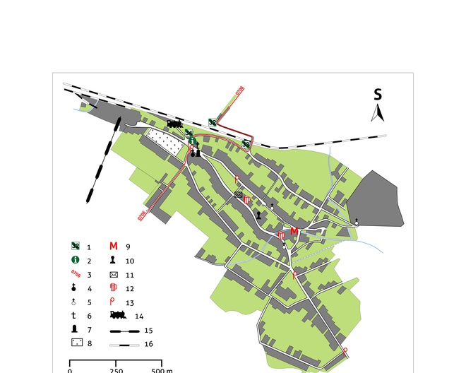
Following the red marking (0706) and taking the local asphalt road we arrive at the tourist signpost Žirany MASL.; information panels of the Zobor Hills Educational trail and Kostoľany Educational Trail; parking facilities.
Time: 5 min., in the opposite direction 5 min., length: 200 m, easy.
From the history of the municipality
The oldest archaeological finds on the territory of the municipality date back to the Neolithic Lengyel culture (4800–4400 BC). A fortified settlement of the Lusatian culture (800–600 BC) is located on the Žibrica peak, which was probably inhabited as late as the 12th–13th century AD. Žirany is mentioned for the first time in the Zobor deeds from the years 1111 and 1113, where it is listed as property of the Benedictine monastery of St Hippolytus. In 1349 Žirany and Kolíňany are described as abandoned monastic property. After the dissolution of the monastery in the second half of the 15th century, the municipality was owned by the bishopric of Nitra (until 1848). In the 1570s Žirany was burned down by the Turks. At that time, Turkish troops broke through the Žirany pass (Žiriansky priesmyk) into the central Nitra region and imposed duties on surrounding municipalities. According to the house census carried out in the District of Nitra, Žirany had 47 houses occupied by approximately 300 inhabitants. In 1683 imperial troops passed through the municipality several times and locals had to provide housing for them. In addition, they often had to supply wood to the Nitra fortress. In the second half of the 18th century, a school was built in the municipality under the patronage of the Bishopric of Nitra. In 1787 the municipality had 124 houses and 786 inhabitants. Žirany became an independent parish as late as in 1791.
In 1906 the acclaimed Hungarian composer and collector of folk songs Zoltán Kodály visited the municipality in the company of Béla Bartók. In the 20th century the history of the municipality was marked by the rise of industrial estates linked to limestone quarrying and processing and by a new connection to surrounding areas – the railway.
The economic situation until the end of the 20th century
Since the Middle Ages the inhabitants of Žirany were farmers, winegrowers, foresters, and processed timber. The quality of local winegrowing is attested by a written record dating back to 1379, according to which the Esztergom Canonry reserved the right to import wine from Žirany. Until the mid-20th century, hemp growing and manufacture of hemp canvas, used to make the traditional Žirany costumes, was also spread in the municipality. In 1958 a consolidated agricultural cooperative was established in Žirany, which gradually changed the traditional character of agricultural production in the municipality.
Ethnic structure
The mixed Hungarian-Slovak population that inhabited Žirany in the Middle Ages was decimated by Turkish invasions in the 16th century. Similarly to Jelenec or Ladice, the municipality was repopulated with Magyar settlers from municipalities from the south. In 1715 there were 20 farmsteads, settled by families with the surnames Andraskó, Bús, Bence, Bede, Szabó, Varga, Pók, Bertók, Piros. In 1881 the municipality had 774 inhabitants of which 720 were Hungarians, 26 Slovaks, 23 Jews, and 1 German. Currently approximately 63% of inhabitants declare themselves to be of Hungarian nationality, the rest of Slovak nationality (37%).
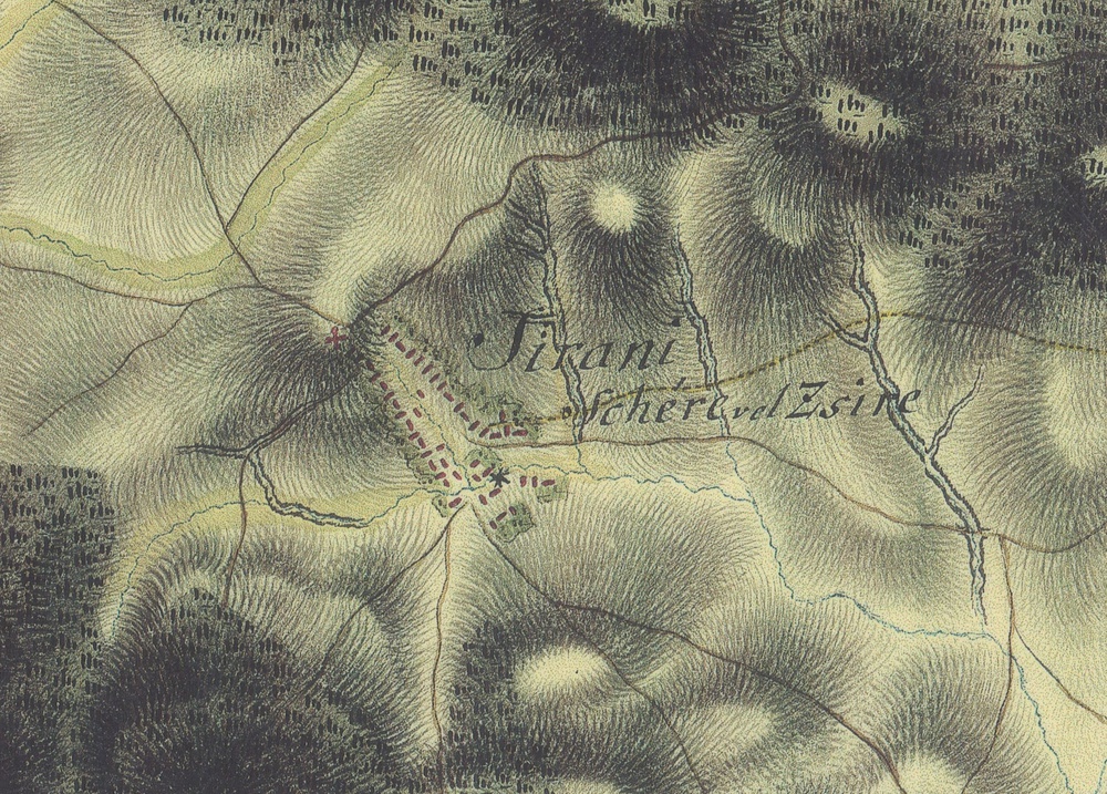
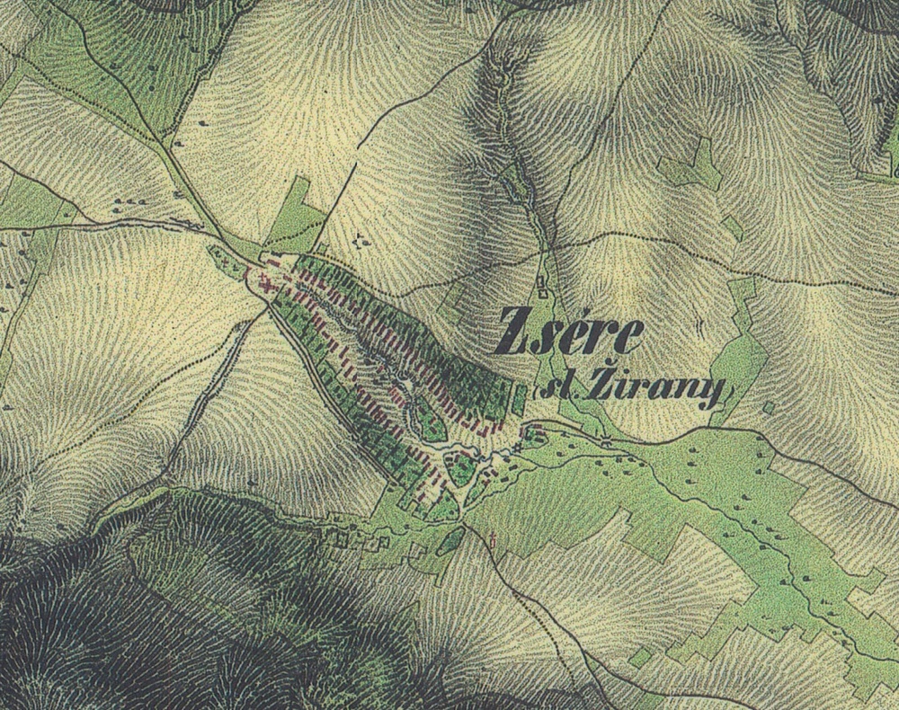
In written sources, the municipality is referred to under different names: Sire (in 1111, 1113, 1295) Syra (1349), Syre (1536, 1598), Zsére or Zeré (1773), Zsére or Žirany (1808, 1945–1958) and Žirany since 1948.
Urban development
Žirany until the end of the 19th century
The character of the settlement was largely determined by its position in the Žirany breach (Žiriansky prieval), which was a significant communication route from the Žitava region to the central Nitra region.

The historical centre of the municipality formed along two main roads, flanking the deep channel of a stream rising on the slope to the south of the present-day church. In the past only gardens and wells were located on the banks of the stream between both roads. Houses typically arranged in long yards were oriented with their front façades towards the street. In the late 19th century the lower end of the municipality reached approximately to the connecting road of the two main roads.

As a result of industrial construction after 1945 and especially from the 1960th onwards, new streets and company dwellings as a new type of architecture appeared on the perimeter of the historical centre of Žirany.
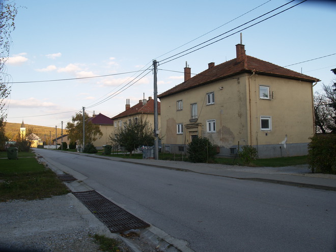
In the 1960s and 1970s the centre of the municipality changed as well. A new post office, a multi-purpose building of the local national committee (today´s municipal office), a grocery, a general store, and a pub were newly built.
Industrial areas
A forerunner to the rise of industrial zones in Žirany was manual limestone quarrying and production of burnt lime in simple kilns on the eastern slopes of Vápenník and Žibrica, as documented until the 17th century. In the late 19th and the first half of the 20th century, local Roma made unburnt bricks in a large clay pit on the southern border of the then cadastral area. The construction of the railway Zbehy – Zlaté Moravce in the years 1936–1968 on the north-western border of the municipality was accompanied by the erection of the personal and cargo railway station Žirany (station no. 33). Behind the railway station, the lime works were erected in the 1950s, connected with a ropeway conveyer to the lime quarry under Žibrica (station no. 32). After 1958 the estate of the consolidated agricultural cooperative was established near the field road to Jelenec, today´s University Agricultural Company of the Slovak Agricultural University.
Architecture
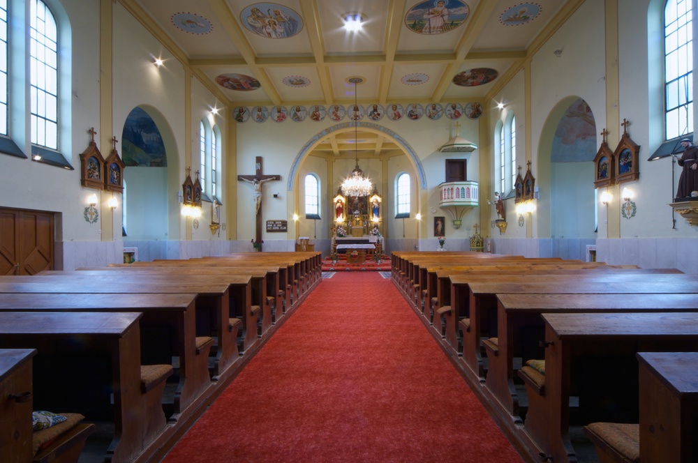
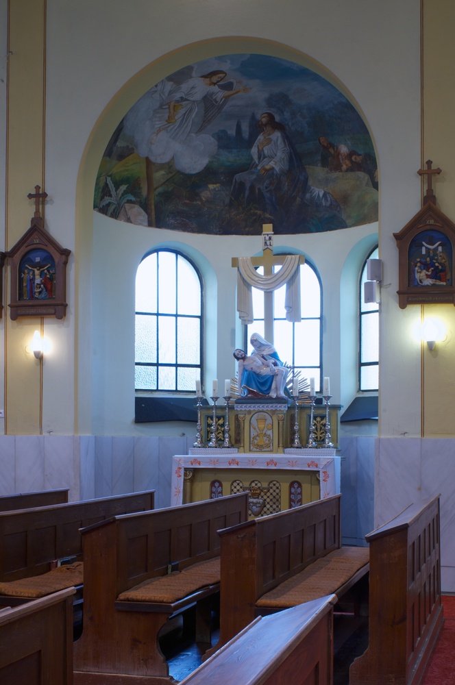
The Church of St Nicholas
The original Baroque church from 1734 was dismantled due to structural problems in June 1938. The current structure was erected in 1938–1939 according to the project of Anton Luif. The construction was carried out by the Nitra-based building company of Ján Tomaschek. The church is single-aisled with a polygonal apse, reinforced concrete ceiling, annexed sacristies, and two side chapels.
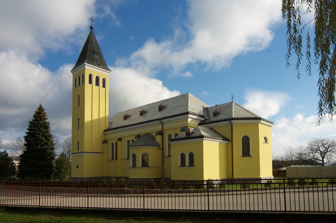

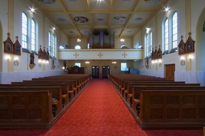
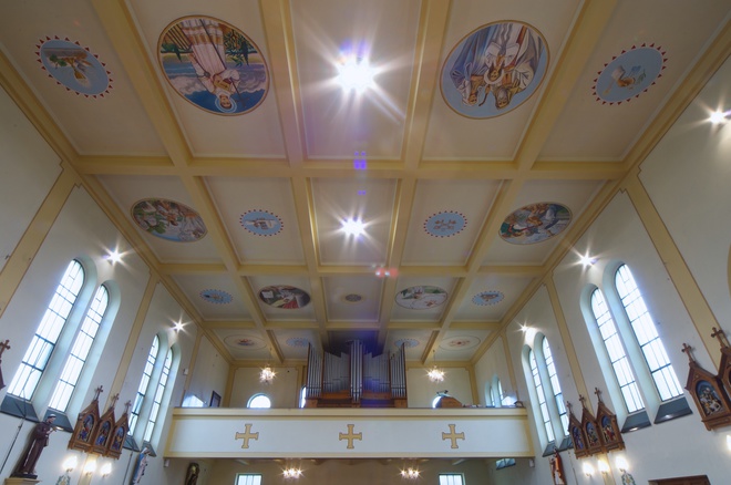

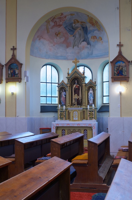
The furnishings were made for the newly erected church with the support of the inhabitants of the municipality. The main altar, made by the Drozd Company in Nováky, is dedicated to the patron of the church St Nicholas. The central painting is by the local native František Szórád, who also painted the church in the 1970s. The marble holy water fonts come from the older Baroque church.
Small architecture
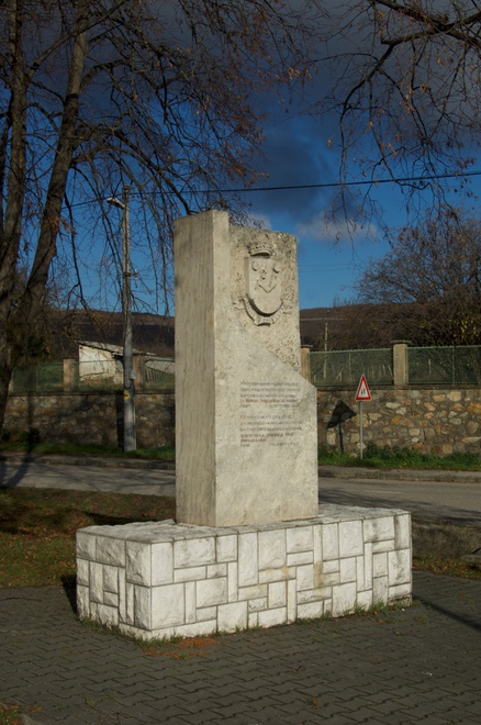
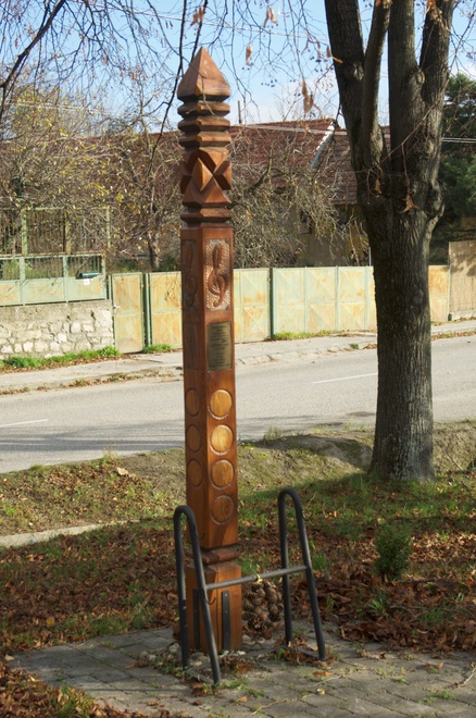
Significant memorial structures are located in the vicinity of the church: the Hope Memorial unveiled in 1994 on the occasion of the Dorog Challenge, related to the commemoration of victims of the World Wars and a memorial wooden column built in 2008, dedicated to the composer and collector of folk songs Eugen Szíjjártó (1919–1986), on whose initiative the songs from the Zobor area were published in collections of folk songs. The parish garden features a stone cross from 1823, commissioned by the Bishop Jozef Kluch. A Lourdes cave from 1927 is located next to the church.
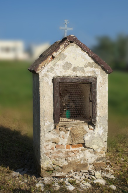
St Wendelin Chapel from 1912 is located in the southern part of the original cadastral area. Outside the central municipal area, other small-scale Church monuments are scattered: a chapel of St Urban from 1795 in the vineyard, the chapel of St John of Nepomuk from 1843 on the outskirts of the former consolidated agricultural cooperative and the Chapel of St Andrew the Apostle dating back to 1895 near the turn-off towards Jelenec.
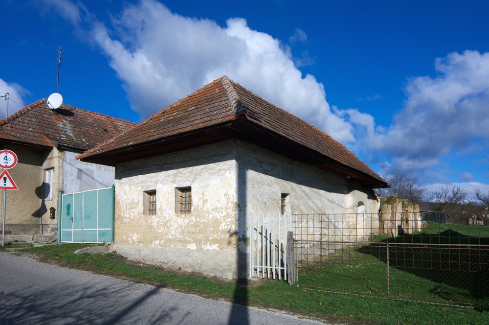
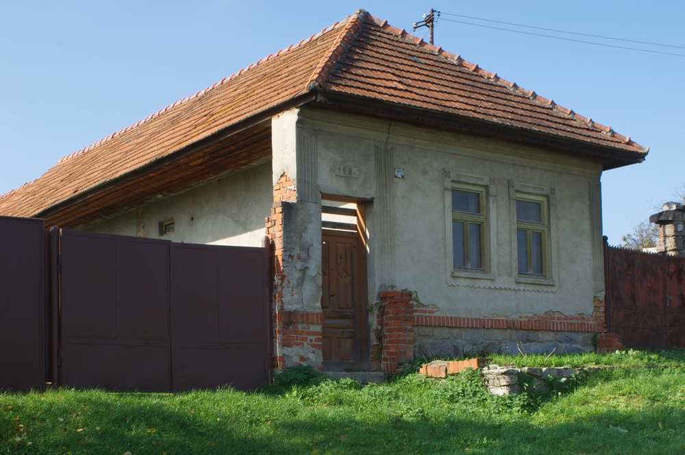
Folk architecture
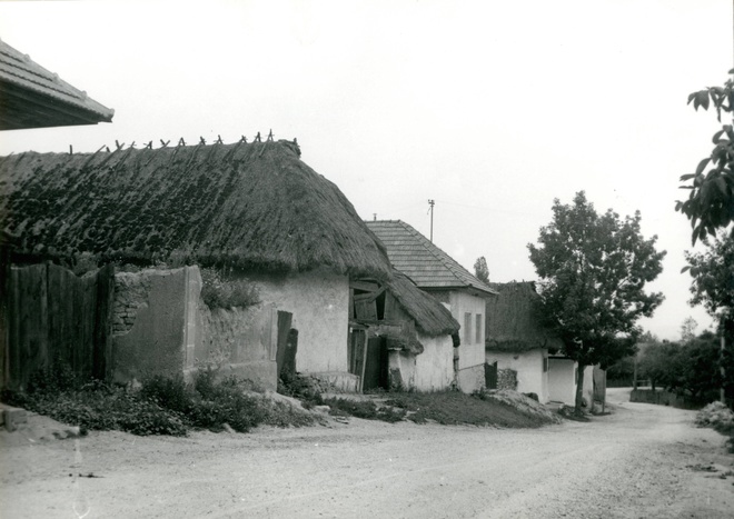
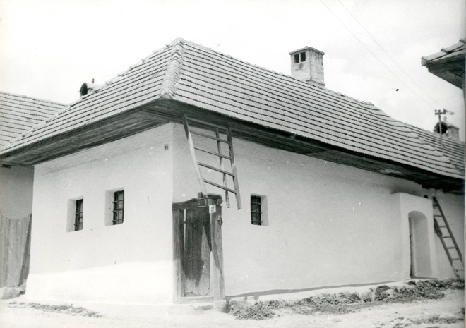
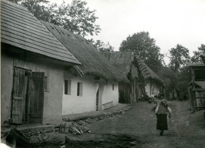
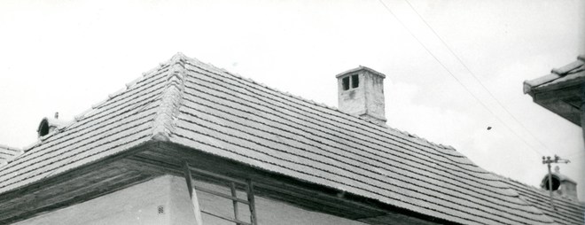
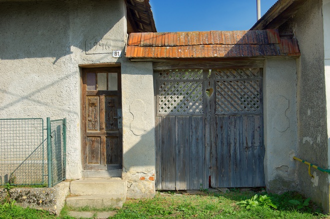
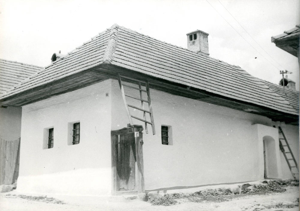
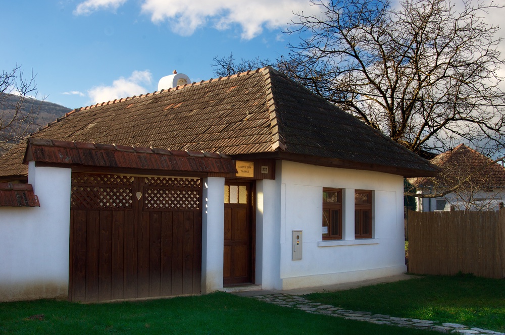
In the area of the two oldest streets, several transversal peasant houses from the late 19th and early 20th century have been preserved. They are mostly single-tract, three-part, four-room structures built of unburnt brick on a stone base wall. In the front was the hall, behind it the hallway (pitvor) with the smoke kitchen and in the back was the pantry. Originally, roofs were covered with straw, which was gradually replaced by ceramic covering. In the oldest houses, the street façade with two small windows was undecorated, smooth, whitewashed with lime. One such house – the Folk House (Tajház) – stands near the building with the local ethnography exposition. The street façade is biaxial, symmetrical, divided by an older type of inset windows with bars in the depth of the wall and with inner unadorned window casements. On the yard-facing side façade, a vaulted portal (žudro), locally known as gádor, was preserved in front of the hallway, the entrance to the dwelling parts. Typical are also double or triple houses with a common yard.

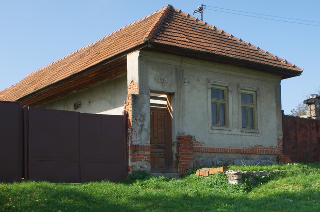
Burnt bricks only became wide-spread as building material in the inter-war period and predominant in the second half of the 20th century.
Viaceré domy z tohto obdobia majú priečelie zdobené plastickou geometrickou výzdobou. V niektorých prípadoch sa dodnes zachovala pôvodná drevená brána s vrátami či pôvodné drevené okná.
Interesting events
Annual ball (April) and Municipal Days (June)
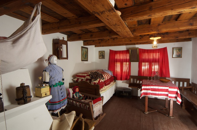
Museum Folk House in Žirany (Tájház) with an exhibition of folk culture. Opening hours: by arrangement with the Municipal Office Contact: Municipal Office Žirany, 194, Žirany, 951 74 Žirany Tel: +037/631 88 41, +631 88 42 Email: [email protected]
