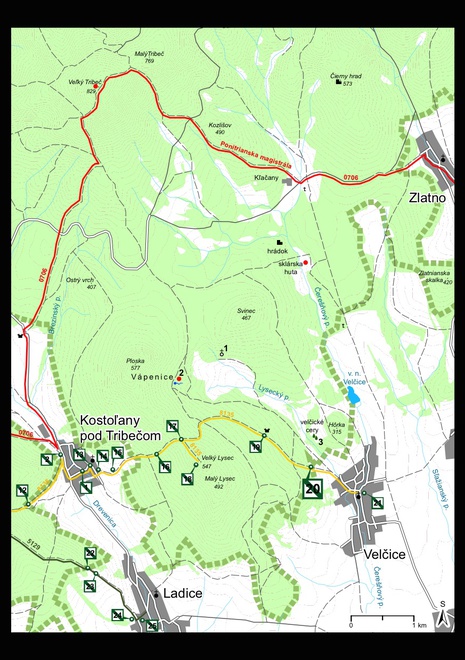
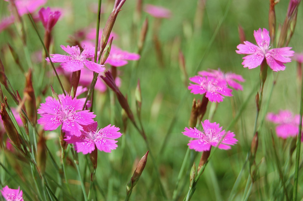
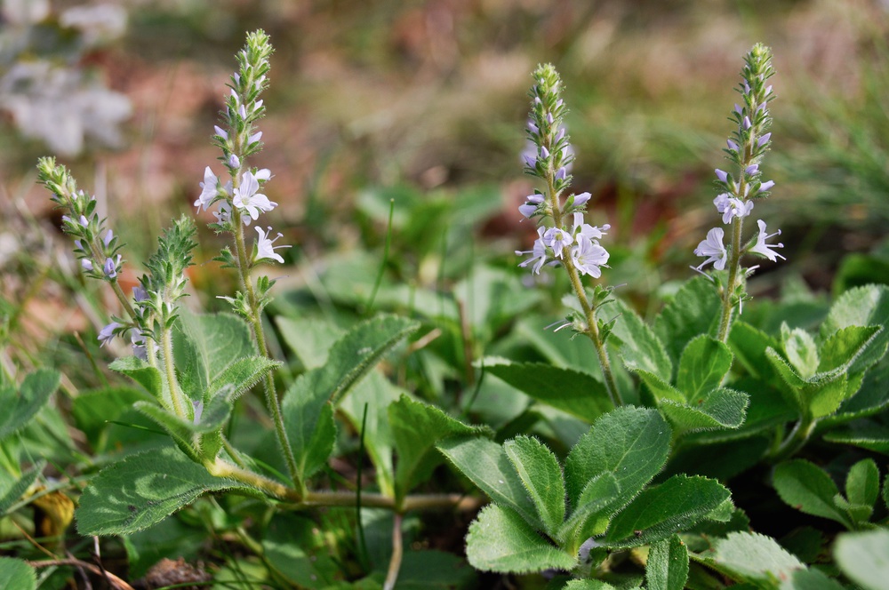
Meadows of Velčice
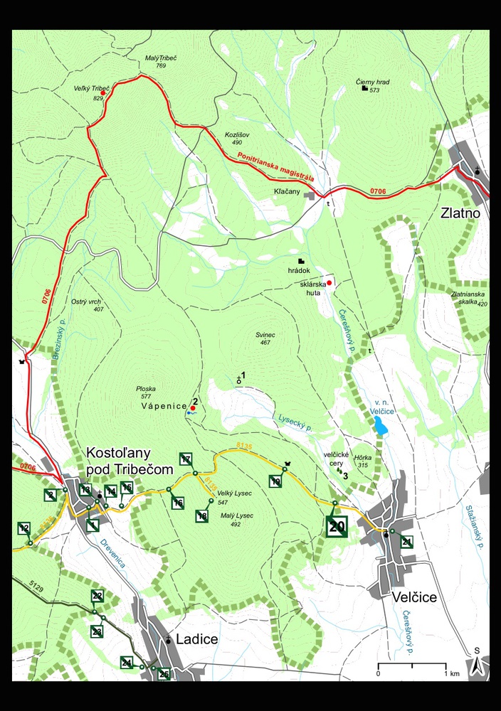
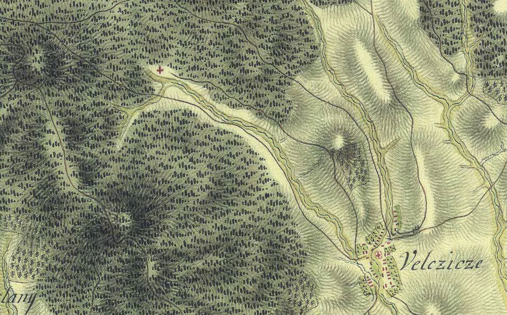
Station No. 20 is situated in the valley of the Lysecký stream on the border of the Protected Landscape Area (CHKO) Ponitrie in the north-western part of the cadastre of Velčice, which is mostly composed of meadows. These belong to the semi-natural vegetation type and have developed after long periods of husbandry (mowing, pasturing). The subsoil consists of quartzite, a rock typical for the borderland of the Tribeč Mountains. The properties of quartzite, especially high pH values and insufficient nutrients, are reflected in the composition of the vegetation with dominating acidophilic species. Among the grasses we may mention common bent (Agrostis capillaris) or sweet vernal grass (Anthoxanthum odoratum); among the flowering plants for example maiden pink (Dianthus deltoides), mouse-ear hawkweed (Pilosella officinarum), common speedwell (Veronica officinalis), heath dog-violet (Viola canina) or broad-leaved thyme (Thymus pulegioides).
From the gamekeeper’s lodge pod Lyscom (below Lysec Mountain; station No. 19) we follow the yellow marking (8135) slightly descending to the southeast. After about 700 m we arrive at a crossing with an asphalt road that continues straight on the border of the forest to station No. 20.
Time: 10 min., in the opposite direction 15 min., length: 1 km, easy.


Most of the meadows in the valley of the Lysecký stream are not husbanded anymore and are becoming overgrown by trees. Certain peculiarities on the Velčice meadows are not accessible by marked trails.
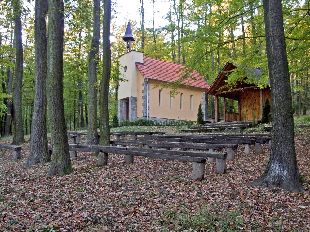
The Chapel of the Holy Cross and Our Lady of Sorrows
The chapel is accessible on an unmarked, asphalted forest road, which we reach on the yellow marked trail (8135), slightly descending across overgrown meadows after about 300 m. On the asphalt road we turn left (the yellow tourist marking continues on the right of the municipality of Velčice) and continue along the fence of the game park to the northwest. Soon we pass a crossing with an asphalt road from the left (southeast), which is the road we have taken descending from the gamekeeper’s lodge below Lysec Mountain (station 19). From this crossing we continue straight ahead for about 600 m to the place, where from the right (northwest) a broader rutted forest road. We turn to this road, which gently descends to the valley of the Lysec Stream flowing across the Trnava meadows. After passing this stream we continue slightly ascending to the northwest and soon along the border of the meadow to the northeast, where we arrive at the chapel (467 MASL.).
Time: 50 min. in the opposite direction 40 min., length 3 km, easy.
The Chapel of the Holy Cross and of Our Lady of Sorrows was erected by a local native, Antonius Beláni, Canon at Bratislava. The chapel was covered by a shingle roof and had a small tower. A polychromatic statue of the Sorrowful Mother is placed in the chapel. Antonius Beláni had the precious reliquary of the Holy Cross brought from Rome in 1748 and created a fund to care for the eternal flame. The chapel decayed during the 19th and in the first half of the 20th century to such an extent that after World War II it collapsed. By help of public donations and volunteers the chapel was renewed in 1951–1953, and the original statue of Our Lady in Sorrows restored. In 2007 the façade of the chapel was renovated and the roof covering replaced.

Masses are celebrated next to the chapel in the open from May to September once a month, on condition of favourable weather (the last one on the feast of Our Lady of Sorrows).
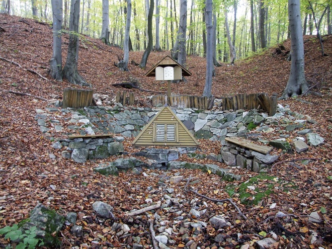
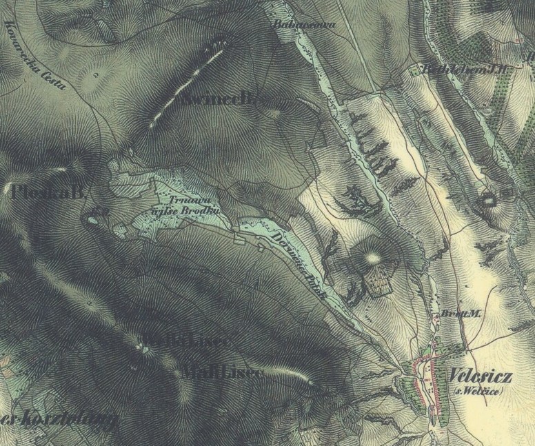
Horná studnička (Upper spring) at Vápenice
The spring at Vápenice can be reached by an asphalted forest road, which is described already in the part devoted to the Chapel of the Holy Cross and Our Lady of Sorrows. We continue this road after the crossing which leads to the chapel about 1.5 km to the place, where the road is crossed by a right-hand tributary of the Lysecký Stream. This place is situated in a sharp turn to the right, where we have to turn from the asphalted road to the left (westwards) on a forest road, which will lead us after 200 m to a small meadow. The spring is to be found in its north-western part (360 MASL).
Time: 60 min., opposite direction 45 min., length 3.5 km, slightly challenging.
A number of small springs are maintained in the area of the spring pool of the Lysecký stream and its left-bank tributary in the cadastral sections Vápenice and Trnava. Horná studnička (Upper spring) in Vápenice, at the forest border above Dušanova lúka (Dušan’s Meadow), is the best accessible among them. The Velčice native Ľuboš Krajči and his friends have created its current appearance in 2003.
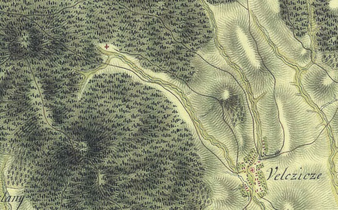
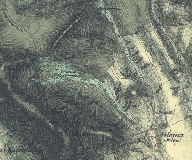
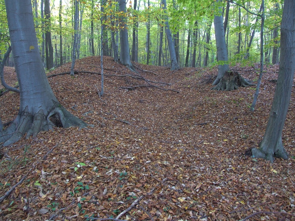
The surrounding area of the spring has an interesting history as well. The name Vápenice (‘vápno‘ means lime) itself suggests that lime was burnt here. Lime kilns are shown in this area on a map from 1843.
Today only more or less visible depressions are preserved from the kilns, surrounded by heaps of earth, sometimes up to 2 m high, containing fragments of quartzite and vitric, burnt pieces from the kiln walls.

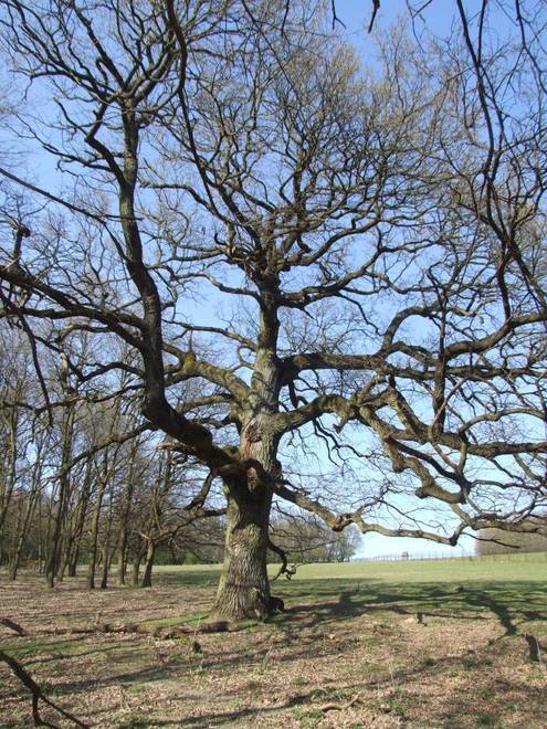
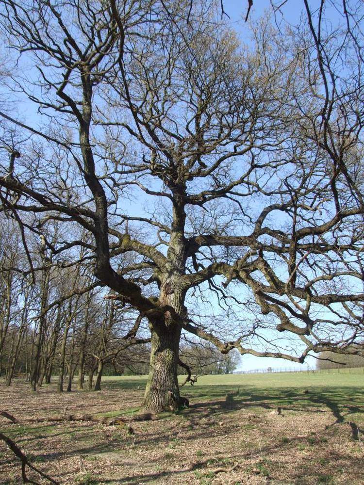
The Turkey oaks of Velčice
The area of the fallow park on the eastern bank of the Lysecký stream, about 500 m to the north is fenced and closed for the public. On the border of one of the meadows we can find a botanical peculiarity: a group of 19 Turkey oaks (Quercus cerris L.) that have been declared protected trees in 1987. The Velčice Turkey oaks belong to the largest group of this species that are not part of a forest in Slovakia. Their heights range between 18 and 26 m and show circumferences of 234–530 cm. Their age can be estimated at 350 years.